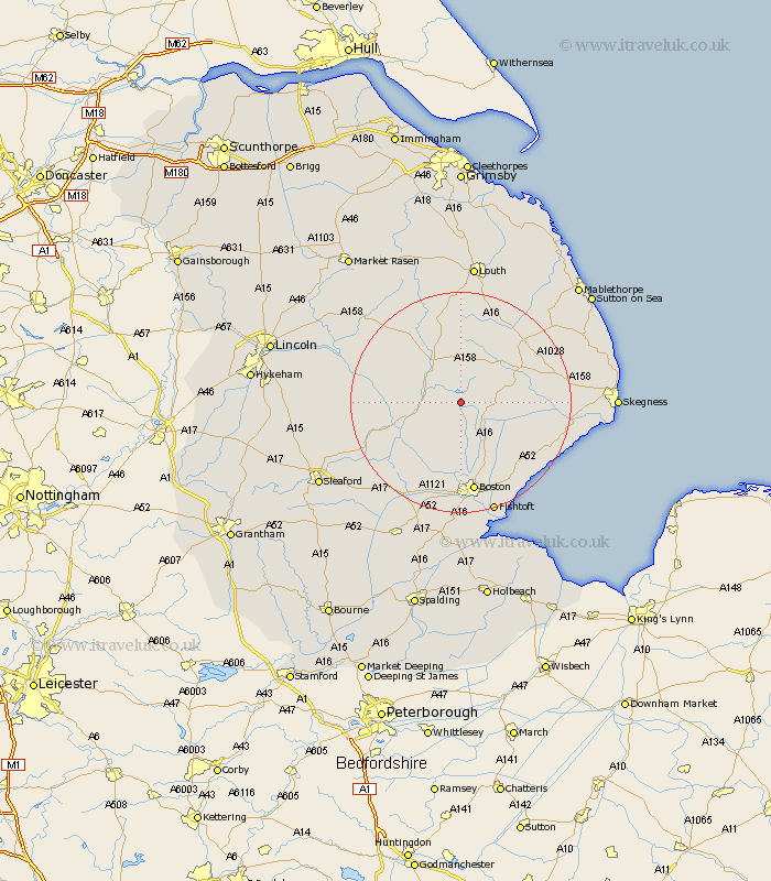
Lincolnshire Map Showing Location of Revesby
Population: 247
District: East Lindsey
Easting: 530442 Northing: 361379
Latitude: 53.13 Longitude: -0.05
 = Revesby
District: East Lindsey
Easting: 530442 Northing: 361379
Latitude: 53.13 Longitude: -0.05
= Revesby
This Revesby map below is supplied by Google. Use the tools in the top left corner to zoom into street level or zoom out for a road map, you may also need to zoom in to see Revesby on the map. Click and drag the map to move around. If the map fails to load try and refresh your browser or zoom in or out (+ or -).
Update - it seems Google no longer allow people to use their maps for free! This Revesby map sometimes loads and sometimes gives a error. I am working on a solution.
Closest 30 Towns or Cities to Revesby (Population over 500)
Carrington 5.56km Mareham-on-the-Hill 5.67km Mareham 5.67km Mareham on the Hill 5.67km Stickney 7.12km Coningsby 8km Banovallum 8.65km Horncastle 8.65km Tattershall 10.67km Frithville 11.18km Woodhall Spa 11.27km Spilsby 11.44km Sibsey 11.98km Wrangle 15.73km Old Leake 16.39km Leake 16.39km Billinghay 16.54km Boston 16.83km Brothertoft 17.01km Friskney 17.25km Leverton 17.29km Butterwick 18.41km Benington 18.91km Bennington 18.91km Martin 19km Willoughby 19.07km Frieston 19.69km Freiston 19.69km Croft 20.01km Bardney 20.05km