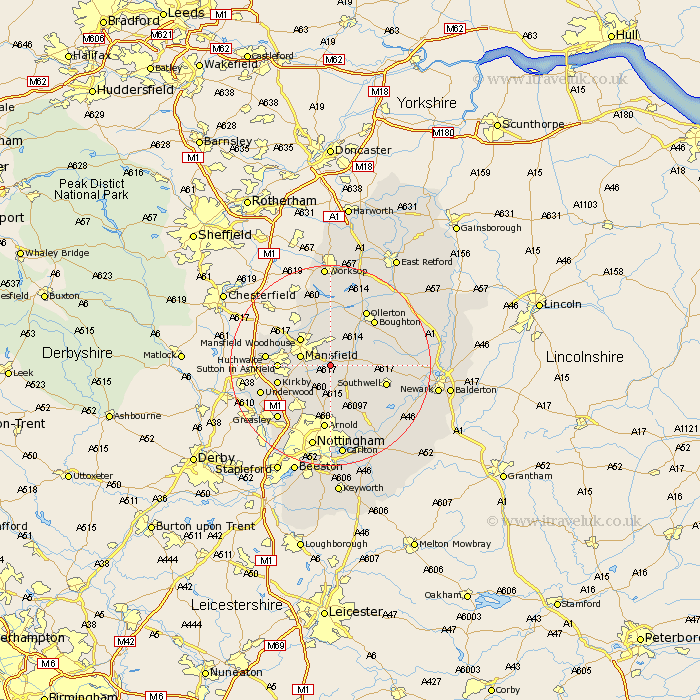
Nottinghamshire Map Showing Location of Rainworth
Population: 7321
Area Size (ha): 158
District: Newark and Sherwood
Easting: 459114 Northing: 358121
Latitude: 53.12 Longitude: -1.12
 = Rainworth
Area Size (ha): 158
District: Newark and Sherwood
Easting: 459114 Northing: 358121
Latitude: 53.12 Longitude: -1.12
= Rainworth
This Rainworth map below is supplied by Google. Use the tools in the top left corner to zoom into street level or zoom out for a road map, you may also need to zoom in to see Rainworth on the map. Click and drag the map to move around. If the map fails to load try and refresh your browser or zoom in or out (+ or -).
Update - it seems Google no longer allow people to use their maps for free! This Rainworth map sometimes loads and sometimes gives a error. I am working on a solution.
Closest 30 Towns or Cities to Rainworth (Population over 500)
Blidworth 3.88km Clipstone 5.67km Mansfield 5.86km Bilsthorpe 5.86km Farnsfield 5.86km Mansfield Woodhouse 7.86km Edwinstowe 8.12km Oxton 8.13km Papplewick 8.65km Newstead 8.69km Warsop 9.53km Calverton 9.54km Claverton 9.54km Sutton in Ashfield 10.01km Pleasley 10.49km Kirkby 10.68km Kirkby in Ashfield 10.68km Southwell 11.24km Annesley 11.59km Woodborough 11.61km Huthwaite 12.37km Hucknall under Huthwaite 12.37km Hucknall 12.37km Hucknall-under-Huthwaite 12.37km Boughton 12.39km Ollerton 12.96km Arnold 13.02km Underwood 14.44km Selston 14.47km Greasley 14.97km