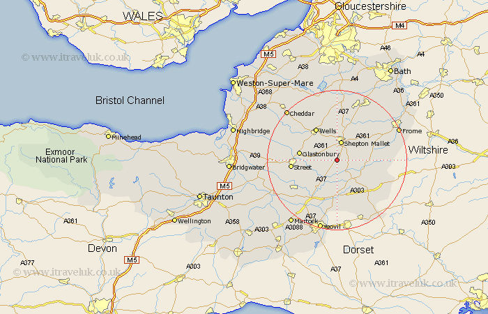
Somerset Map Showing Location of Pylle
Population: 176
District: Mendip
Easting: 360354 Northing: 137325
Latitude: 51.13 Longitude: -2.57
 = Pylle
District: Mendip
Easting: 360354 Northing: 137325
Latitude: 51.13 Longitude: -2.57
= Pylle
This Pylle map below is supplied by Google. Use the tools in the top left corner to zoom into street level or zoom out for a road map, you may also need to zoom in to see Pylle on the map. Click and drag the map to move around. If the map fails to load try and refresh your browser or zoom in or out (+ or -).
Update - it seems Google no longer allow people to use their maps for free! This Pylle map sometimes loads and sometimes gives a error. I am working on a solution.
Closest 30 Towns or Cities to Pylle (Population over 500)
Ditcheat 2.97km Pilton 3.89km Evercreech 5.01km Shepun 5.68km Shepton Mallet 5.68km Baltonsborough 6.1km West Pennard 6.1km Castle Cary 6.57km Barton St David 6.9km Barton St. David 6.9km Barton Saint David 6.9km Butleigh 8.95km Bruton 10.02km Redlynch 10.02km Charlton Mackrell 10.18km Glastonbury 10.7km Wells 10.94km Wookey 11.01km Compton 11.11km Sparkford 11.12km North Cadbury 11.66km Leigh on Mendip 12.34km Leigh 12.34km Leigh-on-Mendip 12.34km Leigh upon Mendip 12.34km Holcombe 12.55km Wincanton 12.9km Street 12.93km Queen Camel 13.02km Coleford 13.12km