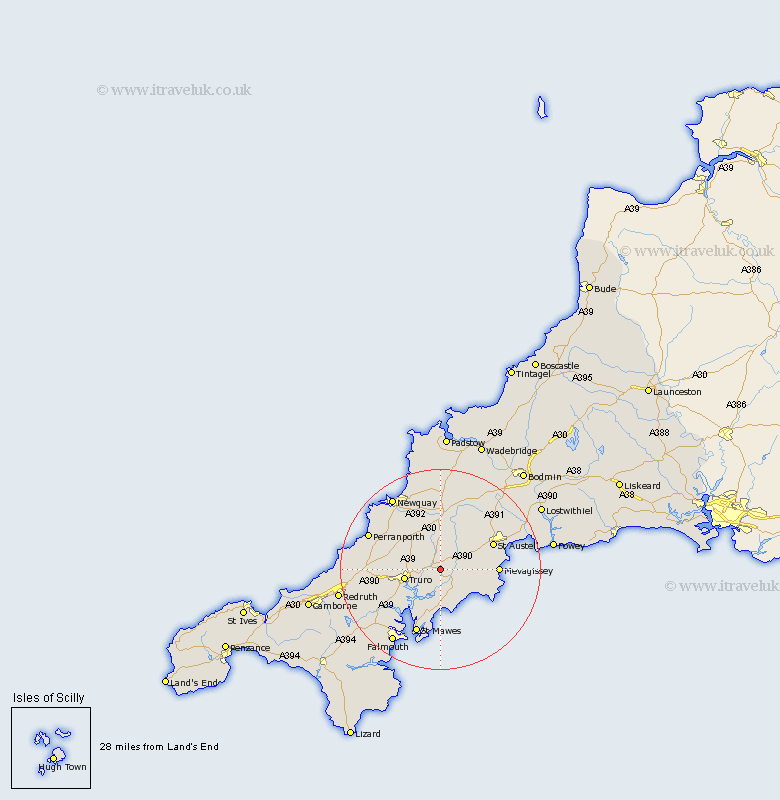
Cornwall Map Showing Location of Probus
Population: 1783
Area Size (ha): 43
District: Carrick
Easting: 189864 Northing: 46824
Latitude: 50.28 Longitude: -4.95
 = Probus
Area Size (ha): 43
District: Carrick
Easting: 189864 Northing: 46824
Latitude: 50.28 Longitude: -4.95
= Probus
This Probus map below is supplied by Google. Use the tools in the top left corner to zoom into street level or zoom out for a road map, you may also need to zoom in to see Probus on the map. Click and drag the map to move around. If the map fails to load try and refresh your browser or zoom in or out (+ or -).
Update - it seems Google no longer allow people to use their maps for free! This Probus map sometimes loads and sometimes gives a error. I am working on a solution.
Closest 30 Towns or Cities to Probus (Population over 500)
Probus 0km Tregoney 3km Creed 3.55km Ladock 3.71km St. Stephen 6.6km Saint Stephen 6.6km St Stephen 6.6km Truro 7.34km Veryan 7.77km St. Ewe 8.49km St Ewe 8.49km Saint Ewe 8.49km Kenwyn 8.49km Kea 9.02km St. Feoch 11.68km St Feoch 11.68km St Feock 11.68km Saint Feock 11.68km Saint Feoch 11.68km St. Feock 11.68km Feock 11.68km Mevegissey 11.84km Mevagissey 11.84km St Austell 12.02km Saint Austell 12.02km St. Austell 12.02km St Dennis 12.09km Saint Denis 12.09km Saint Dennis 12.09km St. Dennis 12.09km