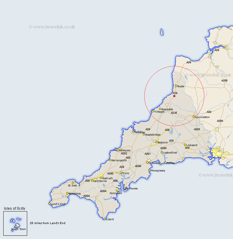
Cornwall Map Showing Location of Poundstock
Population: 805
District: North Cornwall
Easting: 220200 Northing: 99509
Latitude: 50.77 Longitude: -4.55
 = Poundstock
District: North Cornwall
Easting: 220200 Northing: 99509
Latitude: 50.77 Longitude: -4.55
= Poundstock
This Poundstock map below is supplied by Google. Use the tools in the top left corner to zoom into street level or zoom out for a road map, you may also need to zoom in to see Poundstock on the map. Click and drag the map to move around. If the map fails to load try and refresh your browser or zoom in or out (+ or -).
Update - it seems Google no longer allow people to use their maps for free! This Poundstock map sometimes loads and sometimes gives a error. I am working on a solution.
Closest 30 Towns or Cities to Poundstock (Population over 500)
Marhamchurch 4.38km Markhamchurch 4.38km Bude 7.5km North Petherwin 12.39km Kilkhampton 13.78km Moorwinstow 14.82km Morwenstow 14.82km Forrabury 14.95km Tintagel 17.94km Altarnun 18.57km Camelford 19.14km Launceston 19.67km Lewannick 20.28km South Petherwin 20.4km Lezant 24.79km North Hill 25.46km Linkinhorne 28.99km Blisland 29.35km Cardingham 32.29km Cardinham 32.29km Wadebridge 34.23km Callington 34.5km Dobwalls 35.29km Bodmin 35.37km Liskeard 35.92km Padstow 37.47km Menheniot 38.25km Lanivet 38.39km Saint Issey 39.35km St Issey 39.35km