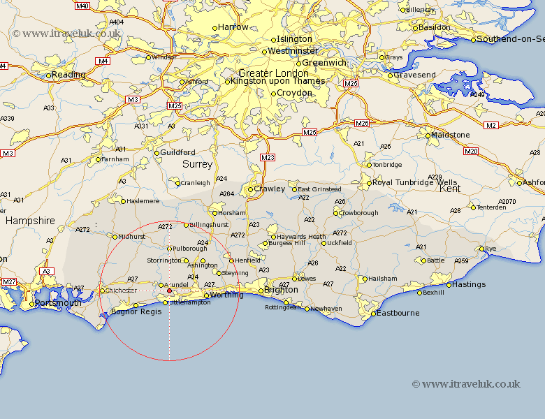
Sussex Map Showing Location of Poling
Population: 173
District: Arun
Easting: 504445 Northing: 104862
Latitude: 50.83 Longitude: -0.52
 = Poling
District: Arun
Easting: 504445 Northing: 104862
Latitude: 50.83 Longitude: -0.52
= Poling
This Poling map below is supplied by Google. Use the tools in the top left corner to zoom into street level or zoom out for a road map, you may also need to zoom in to see Poling on the map. Click and drag the map to move around. If the map fails to load try and refresh your browser or zoom in or out (+ or -).
Update - it seems Google no longer allow people to use their maps for free! This Poling map sometimes loads and sometimes gives a error. I am working on a solution.
Closest 30 Towns or Cities to Poling (Population over 500)
Angmering 2.98km Arundel 2.99km Rustington 3.88km Littlehampton 3.88km Ford 5.03km West Ferring 5.97km Ferring 5.97km East Preston 6.58km Preston 6.58km Yapton 6.93km Walberton 7.26km Kingston 7.27km Bury 8.21km Findon 8.4km Slindon 8.4km Barnham 8.4km Westergate 8.62km Middleton 8.96km Middleton-on-Sea 8.96km Middleton on Sea 8.96km Amberley 9.35km Eastergate 9.36km Bognor Regis 10.37km Storrington 10.52km Worthing 10.64km Bognor 10.89km Felpham 10.89km Washington 11.05km Coldwaltham 11.18km Sompting 11.85km