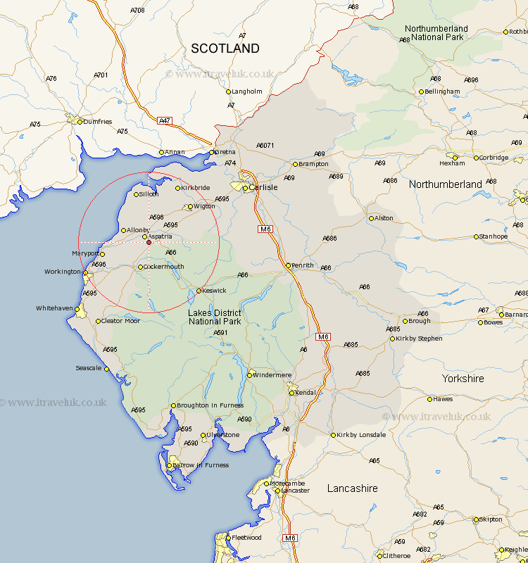
Cumbria Map Showing Location of Plumbland
Population: 367
District: Allerdale
Easting: 315227 Northing: 538398
Latitude: 54.73 Longitude: -3.32
 = Plumbland
District: Allerdale
Easting: 315227 Northing: 538398
Latitude: 54.73 Longitude: -3.32
= Plumbland
This Plumbland map below is supplied by Google. Use the tools in the top left corner to zoom into street level or zoom out for a road map, you may also need to zoom in to see Plumbland on the map. Click and drag the map to move around. If the map fails to load try and refresh your browser or zoom in or out (+ or -).
Update - it seems Google no longer allow people to use their maps for free! This Plumbland map sometimes loads and sometimes gives a error. I am working on a solution.
Closest 30 Towns or Cities to Plumbland (Population over 500)
Aspatria 2.14km Bridekirk 6.42km Crosscanonby 7.49km Cockermouth 7.71km Bromfield 8.08km Dearham 8.36km Broughton Moor 11.12km Brigham 11.27km Maryport 12.34km Westward 13.01km Flimby 14km Silloth 15.18km Wigton 15.42km Dean 16.61km Caldbeck 17.12km Kirkbride 18.28km Workington 18.55km Hesket Newmarket 19.26km Lamplugh 19.29km Koswick 19.62km Keswick 19.62km Thursby 20.4km Distington 21.74km Lowca 23.93km Dalston 24.09km Frizington 24.69km Bowness-on-Solway 24.93km Bowness on Solway 24.93km Parton 25.25km Burgh by Sands 26.6km