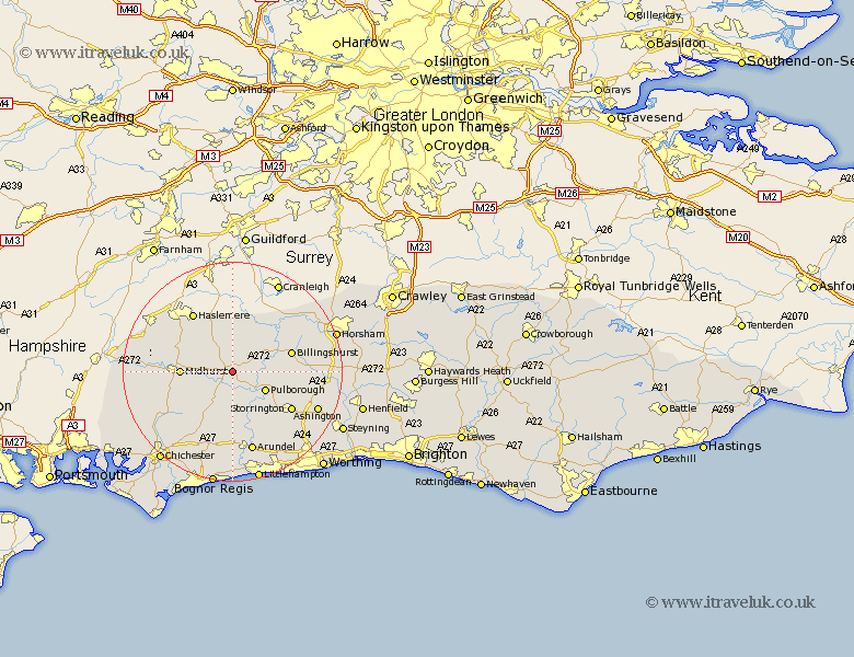
Sussex Map Showing Location of Petworth
Population: 2103
Area Size (ha): 54
District: Chichester
Easting: 498261 Northing: 121425
Latitude: 50.98 Longitude: -0.6
 = Petworth
Area Size (ha): 54
District: Chichester
Easting: 498261 Northing: 121425
Latitude: 50.98 Longitude: -0.6
= Petworth
This Petworth map below is supplied by Google. Use the tools in the top left corner to zoom into street level or zoom out for a road map, you may also need to zoom in to see Petworth on the map. Click and drag the map to move around. If the map fails to load try and refresh your browser or zoom in or out (+ or -).
Update - it seems Google no longer allow people to use their maps for free! This Petworth map sometimes loads and sometimes gives a error. I am working on a solution.
Closest 30 Towns or Cities to Petworth (Population over 500)
Tillington 1.17km Fittleworth 4.38km Kirdford 5.1km Lurgashall 5.96km Pulborough 6.91km Coldwaltham 7.26km Plaistow 7.78km North Chapel 7.78km Northchapel 7.78km Wisborough Green 7.92km Graffham 8.06km Amberley 8.76km Midhurst 9.33km Bury 9.55km Fernhurst 9.88km Loxwood 10.95km Billingshurst 11.13km West Chiltington 11.89km West Chillington 11.89km Storrington 12.77km Iping 12.83km Linchmere 12.85km Thakeham 13.99km Walberton 14.87km Slindon 15.01km Arundel 15.23km Slinfold 15.83km Itchingfield 16.15km Rogate 16.44km Shipley 16.44km