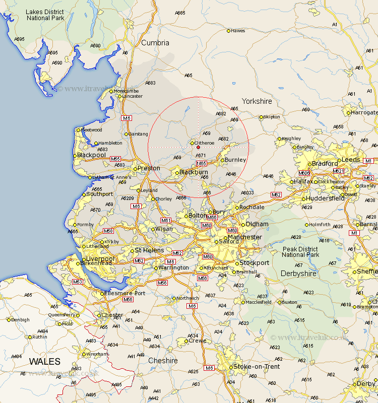
Lancashire Map Showing Location of Pendleton
Population: 203
District: Ribble Valley
Easting: 375881 Northing: 439392
Latitude: 53.85 Longitude: -2.37
 = Pendleton
District: Ribble Valley
Easting: 375881 Northing: 439392
Latitude: 53.85 Longitude: -2.37
= Pendleton
This Pendleton map below is supplied by Google. Use the tools in the top left corner to zoom into street level or zoom out for a road map, you may also need to zoom in to see Pendleton on the map. Click and drag the map to move around. If the map fails to load try and refresh your browser or zoom in or out (+ or -).
Update - it seems Google no longer allow people to use their maps for free! This Pendleton map sometimes loads and sometimes gives a error. I am working on a solution.
Closest 30 Towns or Cities to Pendleton (Population over 500)
Clitheroe 2.87km Chatburn 3.86km Sabden 4.3km Waddington 4.95km Whalley 4.95km Grindleton 5.56km Simonstone 7.5km Altham 7.73km Langho 7.8km Hapton 8.11km Padiham 8.11km Great Harwood 8.11km Accrington 9.33km Clayton le Moors 9.33km Clayton le Moor 9.33km Clayton-le-Moors 9.33km Brierfield 9.5km Barrowford 9.84km Burnley 10.37km Wilpshire 10.66km Nelson 11.09km Church 11.17km Gisburn 11.35km Rishton 11.59km Ribchester 12.27km Colne 13.12km Oswaldtwistle 13.16km Foulridge 13.25km Blackburn 13.5km Barnoldswick 14.12km