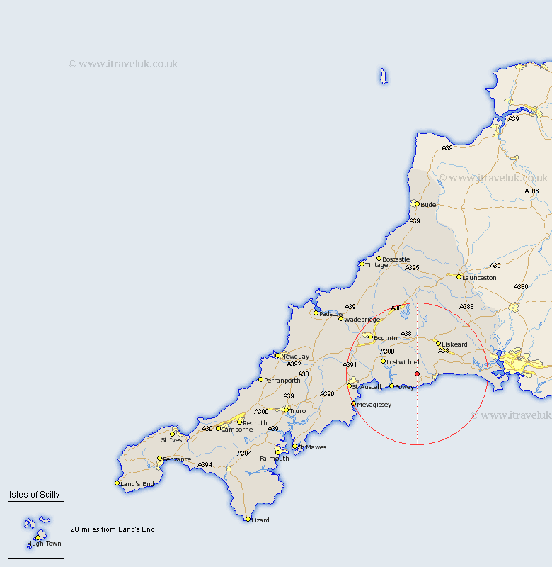
Cornwall Map Showing Location of Pelynt
Population: 1124
District: Caradon
Easting: 219856 Northing: 55002
Latitude: 50.37 Longitude: -4.53
 = Pelynt
District: Caradon
Easting: 219856 Northing: 55002
Latitude: 50.37 Longitude: -4.53
= Pelynt
This Pelynt map below is supplied by Google. Use the tools in the top left corner to zoom into street level or zoom out for a road map, you may also need to zoom in to see Pelynt on the map. Click and drag the map to move around. If the map fails to load try and refresh your browser or zoom in or out (+ or -).
Update - it seems Google no longer allow people to use their maps for free! This Pelynt map sometimes loads and sometimes gives a error. I am working on a solution.
Closest 30 Towns or Cities to Pelynt (Population over 500)
Lansallos 2.37km Lanreath 3km Duloe 4km West Looe 5.91km Looe 5.91km Morval 6.19km Lanteglos 6.98km Fowey 8.01km Dobwalls 9.34km Lostwithiel 10.15km Tywardreath 10.8km Liskeard 10.99km Menheniot 11.1km Par 13.14km St Blazey 13.52km Saint Blazey 13.52km St. Blazey 13.52km Cardinham 15.38km Cardingham 15.38km Bodmin 17.1km Sheviock 17.73km Sherviock 17.73km Lanivet 18.95km Bugle 19km Stenalees 19.04km St Austell 19.28km Saint Austell 19.28km St. Austell 19.28km Blisland 19.77km Mevagissey 20.02km