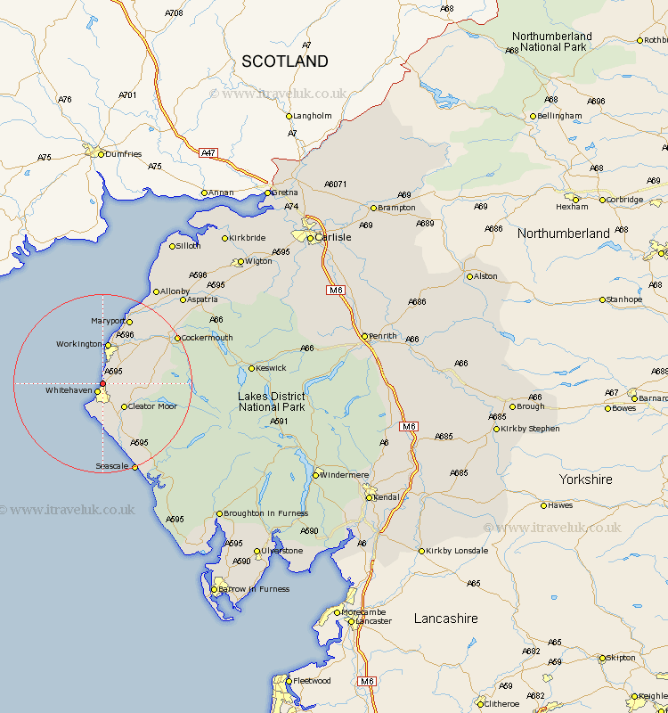
Cumbria Map Showing Location of Parton
Population: 924
District: Copeland
Easting: 297642 Northing: 520218
Latitude: 54.57 Longitude: -3.58
 = Parton
District: Copeland
Easting: 297642 Northing: 520218
Latitude: 54.57 Longitude: -3.58
= Parton
This Parton map below is supplied by Google. Use the tools in the top left corner to zoom into street level or zoom out for a road map, you may also need to zoom in to see Parton on the map. Click and drag the map to move around. If the map fails to load try and refresh your browser or zoom in or out (+ or -).
Update - it seems Google no longer allow people to use their maps for free! This Parton map sometimes loads and sometimes gives a error. I am working on a solution.
Closest 30 Towns or Cities to Parton (Population over 500)
Lowca 1.85km Whitehaven 2.15km Distington 3.71km Cleator Moor 7.03km Frizington 7.44km Saint Bega 7.72km St Bees 7.72km St Bega 7.72km St. Bega 7.72km St. Bees 7.72km Saint Bees 7.72km Workington 9.32km Dean 10.35km Lamplugh 11.82km Egremont 11.92km Flimby 13.66km Brigham 14.18km Broughton Moor 14.98km Maryport 15.76km Dearham 17.69km Cockermouth 18.69km Bridekirk 19.04km Crosscanonby 20.89km Gosforth 20.92km Seascale 21.39km Aspatria 25.96km Koswick 30.3km Keswick 30.3km Bromfield 32.97km Silloth 36.15km