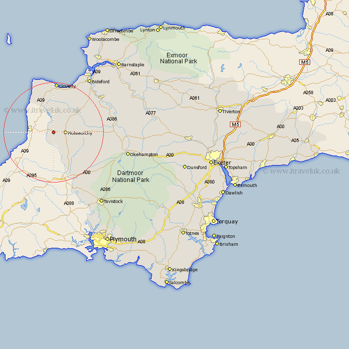
Devon Map Showing Location of Pancrasweek
Population: 218
District: Torridge
Easting: 229782 Northing: 104751
Latitude: 50.82 Longitude: -4.42
 = Pancrasweek
District: Torridge
Easting: 229782 Northing: 104751
Latitude: 50.82 Longitude: -4.42
= Pancrasweek
This Pancrasweek map below is supplied by Google. Use the tools in the top left corner to zoom into street level or zoom out for a road map, you may also need to zoom in to see Pancrasweek on the map. Click and drag the map to move around. If the map fails to load try and refresh your browser or zoom in or out (+ or -).
Update - it seems Google no longer allow people to use their maps for free! This Pancrasweek map sometimes loads and sometimes gives a error. I am working on a solution.
Closest 30 Towns or Cities to Pancrasweek (Population over 500)
Bridgerule 2.2km Pyworthy 2.2km Holsworthy 4.68km Bradworthy 9.55km Ashwater 13.19km Halwill 14.04km Shebbear 14.53km St Giles on the Heath 15.95km St Giles-on-the-Heath 15.95km Saint Giles on the Heath 15.95km Saint Giles-on-the-Heath 15.95km St. Giles 15.95km St Giles 15.95km Saint Giles 15.95km St. Giles-on-the-Heath 15.95km St. Giles on the Heath 15.95km Black Torrington 16.39km Woolsery 16.84km Woolfardisworthy 16.84km Parkham 18.58km Langtree 18.84km Broadwoodwidger 18.91km Buckland Brewer 20.37km Hartland 20.91km Northlew 21.81km Lifton 22.45km Torrington 23.87km Great Torrington 23.87km Hatherleigh 24.59km Bideford 26.29km