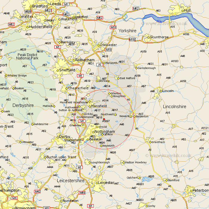
Nottinghamshire Map Showing Location of Oxton
Population: 546
District: Newark and Sherwood
Easting: 462556 Northing: 350745
Latitude: 53.05 Longitude: -1.07
 = Oxton
District: Newark and Sherwood
Easting: 462556 Northing: 350745
Latitude: 53.05 Longitude: -1.07
= Oxton
This Oxton map below is supplied by Google. Use the tools in the top left corner to zoom into street level or zoom out for a road map, you may also need to zoom in to see Oxton on the map. Click and drag the map to move around. If the map fails to load try and refresh your browser or zoom in or out (+ or -).
Update - it seems Google no longer allow people to use their maps for free! This Oxton map sometimes loads and sometimes gives a error. I am working on a solution.
Closest 30 Towns or Cities to Oxton (Population over 500)
Claverton 2.16km Calverton 2.16km Woodborough 3.7km Blidworth 5.79km Farnsfield 5.99km Arnold 7.13km Lambley 7.42km Burton Joyce 7.74km Papplewick 7.8km Southwell 7.86km Rainworth 8.13km Bleasby 9.11km Bilsthorpe 9.53km Shelford 9.85km Newstead 10.19km Fiskerton Ferry 11.14km Fiskerton 11.14km Colwick 11.18km Carlton 11.18km Nottingham 11.43km Nottigham 11.43km East Bridgford 12.11km Annesley 12.25km Mansfield 12.85km Clipstone 13.17km Radcliffe on Trent 13.17km Radcliffe 13.17km Radcliffe-on-Trent 13.17km Flintham 13.39km Kirkby in Ashfield 13.87km