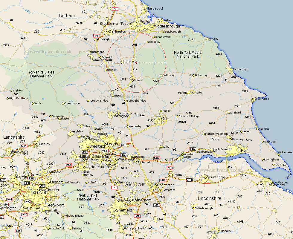
Yorkshire Map Showing Location of Over Silton
Population: 67
District: Hambleton
Easting: 445512 Northing: 493324
Latitude: 54.33 Longitude: -1.3
 = Over Silton
District: Hambleton
Easting: 445512 Northing: 493324
Latitude: 54.33 Longitude: -1.3
= Over Silton
This Over Silton map below is supplied by Google. Use the tools in the top left corner to zoom into street level or zoom out for a road map, you may also need to zoom in to see Over Silton on the map. Click and drag the map to move around. If the map fails to load try and refresh your browser or zoom in or out (+ or -).
Update - it seems Google no longer allow people to use their maps for free! This Over Silton map sometimes loads and sometimes gives a error. I am working on a solution.
Closest 30 Towns or Cities to Over Silton (Population over 500)
Osmotherley 3.71km Brompton 7.79km Northallerton 8.64km Whorlton 9.82km Thirsk 13.14km Middleton upon Leven 14.99km Middleton 14.99km Great Broughton 15.59km Seamer 15.78km Stokesley 16.18km Ingleby 17.07km Topcliffe 17.54km East Cowton 17.73km Cowton 17.73km Helmsley 17.75km North Cowton 17.81km Ampleforth 19.01km Bedale 19.2km Scorton 20.22km Crakehall 20.87km Great Ayton 21.44km Dishforth 21.75km Catterick 21.92km Raskelf 22.48km West Tanfield 22.79km Tanfield 22.79km Nawton 23.37km Kirby Moorside 24.92km Kirkby Moorside 24.92km Easingwold 24.95km