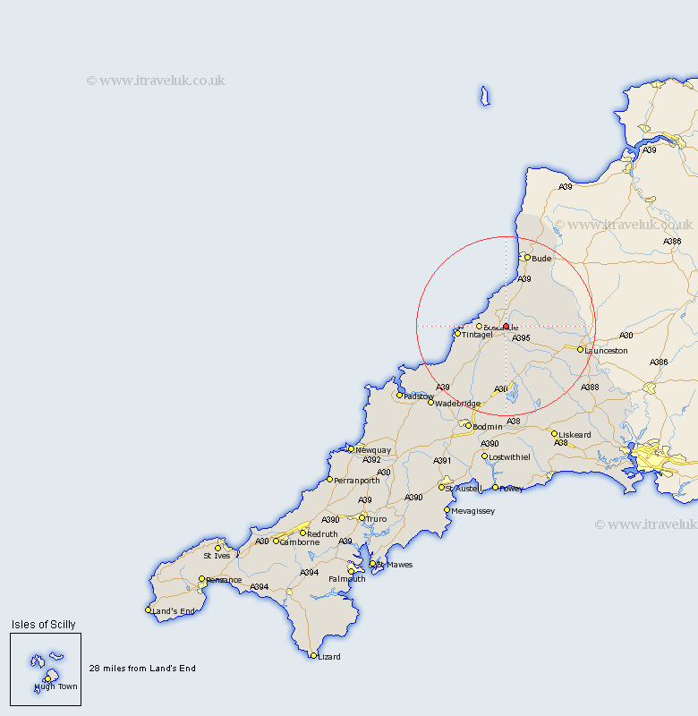
Cornwall Map Showing Location of Otterham
Population: 228
District: North Cornwall
Easting: 216349 Northing: 90360
Latitude: 50.68 Longitude: -4.6
 = Otterham
District: North Cornwall
Easting: 216349 Northing: 90360
Latitude: 50.68 Longitude: -4.6
= Otterham
This Otterham map below is supplied by Google. Use the tools in the top left corner to zoom into street level or zoom out for a road map, you may also need to zoom in to see Otterham on the map. Click and drag the map to move around. If the map fails to load try and refresh your browser or zoom in or out (+ or -).
Update - it seems Google no longer allow people to use their maps for free! This Otterham map sometimes loads and sometimes gives a error. I am working on a solution.
Closest 30 Towns or Cities to Otterham (Population over 500)
Forrabury 8.22km Camelford 9.45km Pounstock 9.92km Poundstock 9.92km Altarnun 10.39km Tintagel 10.73km North Petherwin 11.74km Marhamchurch 14.24km Markhamchurch 14.24km Lewannick 14.96km South Petherwin 16.98km Bude 17.33km Launceston 17.36km North Hill 18.92km Blisland 19.44km Lezant 20.85km Cardingham 22.52km Cardinham 22.52km Linkinhorne 23.44km Kilkhampton 23.7km Moorwinstow 24.35km Morwenstow 24.35km Wadebridge 24.79km Bodmin 25.46km Dobwalls 26.6km Liskeard 28.02km Lanivet 28.49km Padstow 28.84km Callington 29.39km St. Issey 30.25km