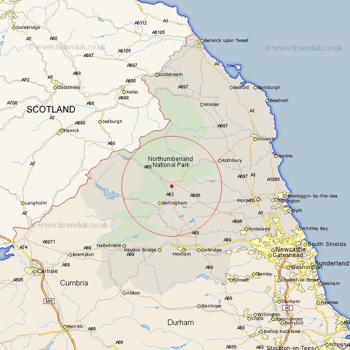
Northumberland Map Showing Location of Otterburn
Population: 550
District: Tynedale
Easting: 389396 Northing: 591402
Latitude: 55.22 Longitude: -2.17
 = Otterburn
District: Tynedale
Easting: 389396 Northing: 591402
Latitude: 55.22 Longitude: -2.17
= Otterburn
This Otterburn map below is supplied by Google. Use the tools in the top left corner to zoom into street level or zoom out for a road map, you may also need to zoom in to see Otterburn on the map. Click and drag the map to move around. If the map fails to load try and refresh your browser or zoom in or out (+ or -).
Update - it seems Google no longer allow people to use their maps for free! This Otterburn map sometimes loads and sometimes gives a error. I am working on a solution.
Closest 30 Towns or Cities to Otterburn (Population over 500)
Bellingham 8.54km Wark 16.98km Rothbury 20.23km Humshaugh 20.5km Chollerton 20.83km Challerton 20.83km Newbrough 24.12km Longframlington 25.4km Longhorsley 25.44km Warden 26.04km Acomb 26.3km Sandhoe 26.99km Stamfordham 27.92km Haydon Bridge 28.12km Hexham 28.12km Swarland 28.98km Corbridge 29.39km Felton 30.49km Hebron 30.9km Haltwhistle 31.01km Morpeth 31.18km Thirston 31.52km East Thirston 31.52km Ponteland 32.33km Hepscott 33.63km Ovingham 33.72km Ridingmill 33.99km Riding 33.99km Pegswood 34.31km Stannington 34.31km