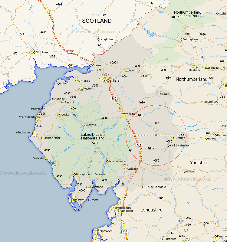
Cumbria Map Showing Location of Great Ormside
Population: 133
District: Eden
Easting: 369805 Northing: 515450
Latitude: 54.53 Longitude: -2.47
 = Great Ormside
District: Eden
Easting: 369805 Northing: 515450
Latitude: 54.53 Longitude: -2.47
= Great Ormside
This Great Ormside map below is supplied by Google. Use the tools in the top left corner to zoom into street level or zoom out for a road map, you may also need to zoom in to see Great Ormside on the map. Click and drag the map to move around. If the map fails to load try and refresh your browser or zoom in or out (+ or -).
Update - it seems Google no longer allow people to use their maps for free! This Great Ormside map sometimes loads and sometimes gives a error. I am working on a solution.
Closest 30 Towns or Cities to Great Ormside (Population over 500)
Appleby 3.86km Crosby Ravensworth 7.75km Long Marton 8.09km Long Marston 8.09km Orton 9.83km Kirkby Stephen 10.56km Kirkby Thore 10.72km Brough 10.91km Shap 13.04km Ravenstonedale 13.36km Tebay 15km Culgaith 15.56km Langwathby 21.07km Millthrop 24.3km Sedbergh 24.3km Milnthorpe 24.3km Dacre 25.39km Lazonby 26.83km Lasonby 26.83km Greystoke 28.85km Staveley 29.24km Dent 29.66km Kirkoswald 29.98km Kendall 30.27km Kendal 30.27km Skelton 31.73km Natland 32.72km Ainstable 34.26km Windermere 34.49km Ambleside 34.81km