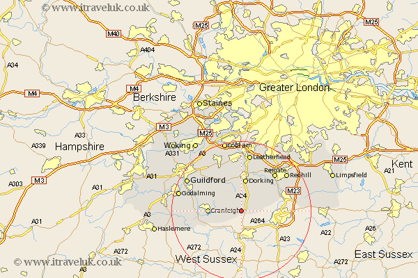
Surrey Map Showing Location of Ockley
Population: 852
District: Mole Valley
Easting: 515433 Northing: 138466
Latitude: 51.13 Longitude: -0.35
 = Ockley
District: Mole Valley
Easting: 515433 Northing: 138466
Latitude: 51.13 Longitude: -0.35
= Ockley
This Ockley map below is supplied by Google. Use the tools in the top left corner to zoom into street level or zoom out for a road map, you may also need to zoom in to see Ockley on the map. Click and drag the map to move around. If the map fails to load try and refresh your browser or zoom in or out (+ or -).
Update - it seems Google no longer allow people to use their maps for free! This Ockley map sometimes loads and sometimes gives a error. I am working on a solution.
Closest 30 Towns or Cities to Ockley (Population over 500)
Capel 2.33km Newdigate 5.01km Ewhurst 5.81km Holmwood 6.03km Abinger 6.56km Wotton 7.77km Westcott 9.27km Cranleigh 9.3km Dorking 9.35km Charlwood 9.49km Leigh 11.01km Shere 11.01km Albury 11.89km Alfold 12.9km Buckland 13.12km Betchworth 13.12km Mickleham 13.18km Horley 13.32km Effingham 13.44km Wonersh 13.94km East Horsley 14.22km Horsley 14.22km Reigate 14.49km Salfords 14.78km Saint Martha 14.87km St. Martha 14.87km Chilworth 14.87km St Martha 14.87km Bramley 15.02km Dunsfold 15.57km