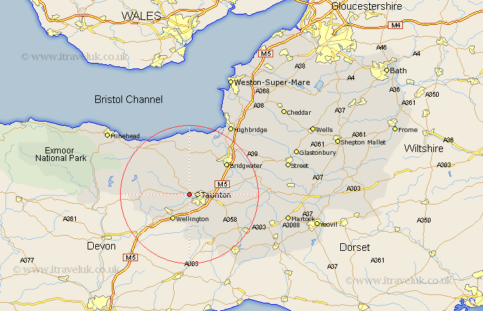
Somerset Map Showing Location of Norton Fitzwarren
Population: 2411
District: Taunton Deane
Easting: 319371 Northing: 126681
Latitude: 51.03 Longitude: -3.15
 = Norton Fitzwarren
District: Taunton Deane
Easting: 319371 Northing: 126681
Latitude: 51.03 Longitude: -3.15
= Norton Fitzwarren
This Norton Fitzwarren map below is supplied by Google. Use the tools in the top left corner to zoom into street level or zoom out for a road map, you may also need to zoom in to see Norton Fitzwarren on the map. Click and drag the map to move around. If the map fails to load try and refresh your browser or zoom in or out (+ or -).
Update - it seems Google no longer allow people to use their maps for free! This Norton Fitzwarren map sometimes loads and sometimes gives a error. I am working on a solution.
Closest 30 Towns or Cities to Norton Fitzwarren (Population over 500)
Norton Fitzwarren 0km Taunton 2.33km Oake 3.95km Trull 4.38km Bishops Lydeard 4.38km Kingston 4.38km Milverton 7.23km West Monkton 7.23km Pitminster 7.76km West Buckland 7.76km Wellington 8.75km Creech Saint Michael 9.51km Creech St. Michael 9.51km Creech St Michael 9.51km Spaxton 9.56km Durleigh 11.61km Wiveliscombe 11.65km Hatch Beauchamp 11.88km North Petherton 11.91km North Curry 12.95km Nether Stowey 13.03km Bridgwater 13.99km Bridgewater 13.99km Stoke St Gregory 15.15km Stoke St. Gregory 15.15km Stoke Saint Gregory 15.15km Stogumber 15.28km Stogursey 16.72km Stoke Courcy 16.72km Stokscourey 16.72km