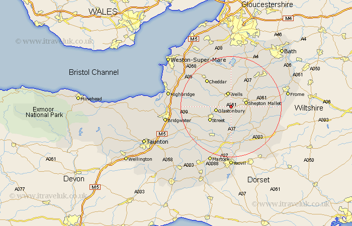
Somerset Map Showing Location of North Wootton
Population: 276
District: Mendip
Easting: 355723 Northing: 141077
Latitude: 51.17 Longitude: -2.63
 = North Wootton
District: Mendip
Easting: 355723 Northing: 141077
Latitude: 51.17 Longitude: -2.63
= North Wootton
This North Wootton map below is supplied by Google. Use the tools in the top left corner to zoom into street level or zoom out for a road map, you may also need to zoom in to see North Wootton on the map. Click and drag the map to move around. If the map fails to load try and refresh your browser or zoom in or out (+ or -).
Update - it seems Google no longer allow people to use their maps for free! This North Wootton map sometimes loads and sometimes gives a error. I am working on a solution.
Closest 30 Towns or Cities to North Wootton (Population over 500)
West Pennard 2.19km Pilton 3.49km Wookey 5.08km Wells 5.68km Baltonsborough 5.68km Glastonbury 6km Shepun 6.1km Shepton Mallet 6.1km Barton St. David 7.51km Barton Saint David 7.51km Barton St David 7.51km Butleigh 8.2km Ditcheat 8.92km Westbury 9.41km Compton 9.43km Evercreech 9.48km Street 9.86km Meare 10.46km Walton 10.84km Charlton Mackrell 11.36km Rodney Stoke 11.59km Chewton Mendip 11.65km Ashcott 12.2km Castle Cary 12.34km Holcombe 12.81km Priddy 13.12km Leigh 13.93km Leigh upon Mendip 13.93km Leigh on Mendip 13.93km Leigh-on-Mendip 13.93km