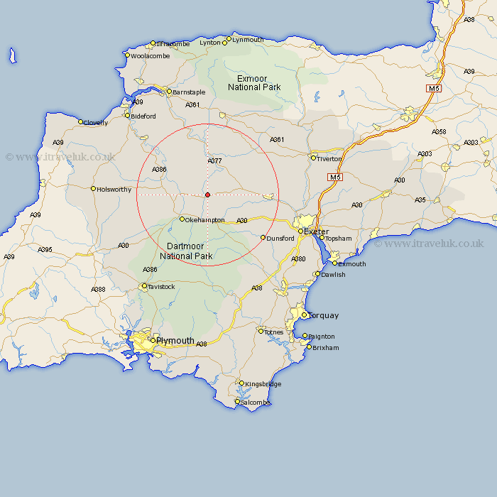
Devon Map Showing Location of North Tawton
Population: 1570
District: West Devon
Easting: 266123 Northing: 101832
Latitude: 50.8 Longitude: -3.9
 = North Tawton
District: West Devon
Easting: 266123 Northing: 101832
Latitude: 50.8 Longitude: -3.9
= North Tawton
This North Tawton map below is supplied by Google. Use the tools in the top left corner to zoom into street level or zoom out for a road map, you may also need to zoom in to see North Tawton on the map. Click and drag the map to move around. If the map fails to load try and refresh your browser or zoom in or out (+ or -).
Update - it seems Google no longer allow people to use their maps for free! This North Tawton map sometimes loads and sometimes gives a error. I am working on a solution.
Closest 30 Towns or Cities to North Tawton (Population over 500)
North Tawton 0km Sampford Courtenay 3.98km Sampford Courtney 3.98km Sampford Courtnay 3.98km Bow 5.86km Nymet Tracey 5.86km South Tawton 7.42km Lapford 10.21km Okehampton 10.22km Copplestone 10.54km Hatherleigh 11.86km Morchard Bishop 11.91km Chawleigh 12.06km Dolton 13.17km Chulmleigh 13.18km Chagford 13.8km Drewsteignton 13.82km Cheriton Bishop 13.87km Barrington 15.23km Burrington 15.23km Northlew 15.68km Sandford 16.5km Tedburn Saint Mary 16.95km Tedburn St. Mary 16.95km Tedburn St Mary 16.95km Crediton 17.67km Witheridge 18.27km Bridestowe 19.14km Moretonhampstead 19.74km High Bickington 19.82km