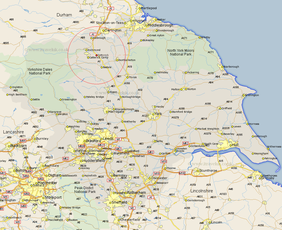
Yorkshire Map Showing Location of Catterick
Population: 2588
Area Size (ha): 183
District: Richmondshire
Easting: 423820 Northing: 496872
Latitude: 54.37 Longitude: -1.63
 = Catterick
Area Size (ha): 183
District: Richmondshire
Easting: 423820 Northing: 496872
Latitude: 54.37 Longitude: -1.63
= Catterick
This Catterick map below is supplied by Google. Use the tools in the top left corner to zoom into street level or zoom out for a road map, you may also need to zoom in to see Catterick on the map. Click and drag the map to move around. If the map fails to load try and refresh your browser or zoom in or out (+ or -).
Update - it seems Google no longer allow people to use their maps for free! This Catterick map sometimes loads and sometimes gives a error. I am working on a solution.
Closest 30 Towns or Cities to Catterick (Population over 500)
Scorton 2.84km North Cowton 6.55km Richmond 7.46km Crakehall 7.49km East Cowton 8.54km Cowton 8.54km Gilling 9.17km Middleton Tyas 9.33km Bedale 9.82km Barton 11.18km Melsonby 13.37km Northallerton 13.48km Leyburn 14.01km Brompton 14.16km Middleham 15.08km Masham 16.71km Tanfield 19.03km West Tanfield 19.03km Grewelthorpe 20.42km Osmotherley 21.59km Kirkby Malzeard 22.26km Whorlton 25.43km Thirsk 25.64km Topcliffe 26.06km Middleton upon Leven 26.2km Middleton 26.2km Bradley 27.31km Dishforth 27.9km Ripon 28.81km Seamer 29.16km