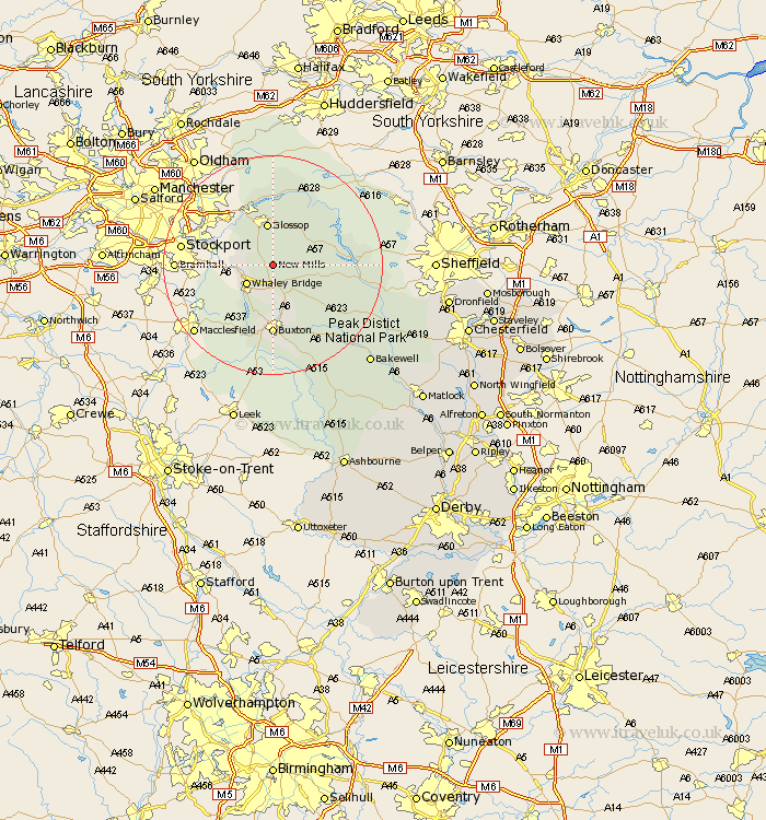
Derbyshire Map Showing Location of New Mills
Population: 8944
Area Size (ha): 191
District: High Peak
Easting: 405544 Northing: 385569
Latitude: 53.37 Longitude: -1.92
 = New Mills
Area Size (ha): 191
District: High Peak
Easting: 405544 Northing: 385569
Latitude: 53.37 Longitude: -1.92
= New Mills
This New Mills map below is supplied by Google. Use the tools in the top left corner to zoom into street level or zoom out for a road map, you may also need to zoom in to see New Mills on the map. Click and drag the map to move around. If the map fails to load try and refresh your browser or zoom in or out (+ or -).
Update - it seems Google no longer allow people to use their maps for free! This New Mills map sometimes loads and sometimes gives a error. I am working on a solution.
Closest 30 Towns or Cities to New Mills (Population over 500)
Hayfield 2.88km Chapel en le Frith 5.67km Whaley Bridge 5.78km Glossop 7.83km Charlesworth 9.24km Castleton 10.62km Hope 11.21km Tintwistle 11.6km Tintwhistle 11.6km Bradwell 12.38km Buxton 12.98km Tideswell 14.93km Bamford 15.6km Hathersage 18.56km Eyam 19.02km Great Longstone 20.67km Longstone 20.67km Stoney Middleton 20.91km Stony Middleton 20.91km Grindleford Bridge 20.98km Grindleford 20.98km Baslow 24.85km Bakewell 24.9km Middleton 25.91km Youlgreave 26.5km Holmesfield 28.14km Darley Dale 30.63km Dronfield 30.79km Barlow 30.86km Brampton 31.41km