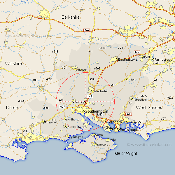
Hampshire Map Showing Location of Chandlers Ford
District: Eastleigh
Easting: 443282 Northing: 120674
Latitude: 50.98 Longitude: -1.38
 = Chandlers Ford
Easting: 443282 Northing: 120674
Latitude: 50.98 Longitude: -1.38
= Chandlers Ford
This Chandlers Ford map below is supplied by Google. Use the tools in the top left corner to zoom into street level or zoom out for a road map, you may also need to zoom in to see Chandlers Ford on the map. Click and drag the map to move around. If the map fails to load try and refresh your browser or zoom in or out (+ or -).
Update - it seems Google no longer allow people to use their maps for free! This Chandlers Ford map sometimes loads and sometimes gives a error. I am working on a solution.
Closest 30 Towns or Cities to Chandlers Ford (Population over 500)
Eastleigh 2.98km Otterbourne 2.98km Hursley 3.89km Bishopstoke 3.96km Chilworth 4.38km Compton 5.1km Twyford 5.96km Southampton 7.14km Romsey 8.17km West End 8.19km Owslebury 8.37km Itchen 9.26km Sparsholt 9.27km Winchester 9.4km Michelmersh 9.88km Michlemersh 9.88km Durley 10.04km Totton 10.19km Upham 10.66km Botley 11.03km Eling 11.61km Kings Somborne 11.61km Marchwood 11.66km Curbridge 11.92km Curdridge 11.92km Bishops Waltham 12.24km Bishop's Waltham 12.24km Kings Worthy 12.55km Hythe 13.02km Ashurst 13.21km