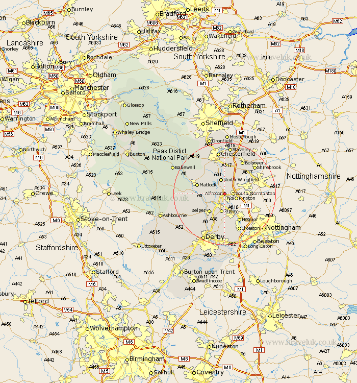
Derbyshire Map Showing Location of Alfreton
Population: 22525
Area Size (ha): 832
District: Amber Valley
Easting: 441285 Northing: 356077
Latitude: 53.1 Longitude: -1.38
 = Alfreton
Area Size (ha): 832
District: Amber Valley
Easting: 441285 Northing: 356077
Latitude: 53.1 Longitude: -1.38
= Alfreton
This Alfreton map below is supplied by Google. Use the tools in the top left corner to zoom into street level or zoom out for a road map, you may also need to zoom in to see Alfreton on the map. Click and drag the map to move around. If the map fails to load try and refresh your browser or zoom in or out (+ or -).
Update - it seems Google no longer allow people to use their maps for free! This Alfreton map sometimes loads and sometimes gives a error. I am working on a solution.
Closest 30 Towns or Cities to Alfreton (Population over 500)
Shirland 2.16km South Normanton 3.34km Morton 3.7km Blackwell 3.82km Wingfield 3.82km South Wingfield 3.82km Swanwick 3.87km Stretton 4.32km Pinxton 4.82km Tibshelf 4.98km Pilsley 5.67km Clay Cross 5.99km North Wingfield 6.06km Crich 6.93km Ripley 7.5km Codnor 7.5km Heage 8.65km Ambergate 8.69km Ambergate Junction Station 8.69km Belper 9.27km Denby 9.33km Tansley 9.64km Ashover 9.98km Matlock 10.67km Ault Hucknall 10.8km Matlock Bath 11.29km Wingerworth 11.61km Heath 11.61km Kilbourne 11.61km Kilbourn 11.61km