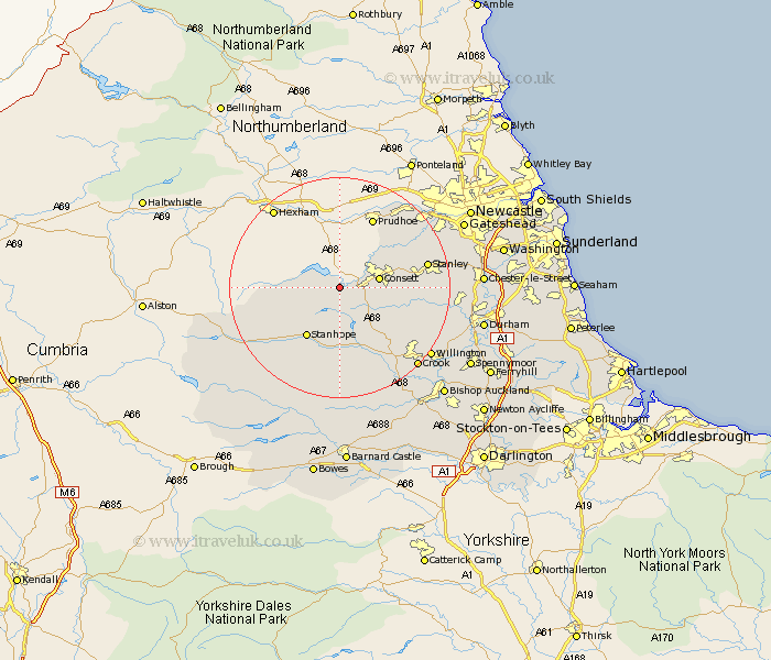
Durham Map Showing Location of Muggleswick
Population: 133
District: Derwentside
Easting: 404282 Northing: 548731
Latitude: 54.83 Longitude: -1.93
 = Muggleswick
District: Derwentside
Easting: 404282 Northing: 548731
Latitude: 54.83 Longitude: -1.93
= Muggleswick
This Muggleswick map below is supplied by Google. Use the tools in the top left corner to zoom into street level or zoom out for a road map, you may also need to zoom in to see Muggleswick on the map. Click and drag the map to move around. If the map fails to load try and refresh your browser or zoom in or out (+ or -).
Update - it seems Google no longer allow people to use their maps for free! This Muggleswick map sometimes loads and sometimes gives a error. I am working on a solution.
Closest 30 Towns or Cities to Muggleswick (Population over 500)
Castleside 4.27km Consetti 6.67km Consett 6.67km Leadgate 9.31km Stanhope 10.69km Cornsay 12.04km Annfield Plain 12.94km Lanchester 12.94km Wolsingham 13.36km Tow Law 13.4km Stanley 15.03km Burnopfield 15.72km Rowlands Gill 15.8km Esh 15.95km Langley Park 17.48km Ushaw Moor 18.99km Edmondsley 19.3km Whickham 19.48km Witton Gilbert 19.57km Crook 19.6km Willington 19.8km Sacriston 20.37km Blaydon 21.04km Ouston 21.59km Ouston Moor 21.59km Pelton 21.66km Brandon 22.31km Lamesley 23.25km High Etherley 23.54km Etherley 23.54km