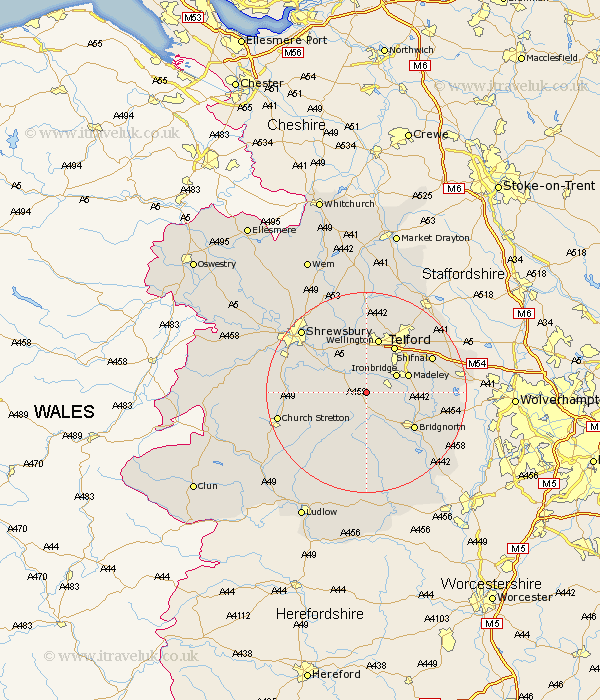
Shropshire Map Showing Location of Much Wenlock
Population: 1906
Area Size (ha): 59
District: Bridgnorth
Easting: 362752 Northing: 300427
Latitude: 52.6 Longitude: -2.55
 = Much Wenlock
Area Size (ha): 59
District: Bridgnorth
Easting: 362752 Northing: 300427
Latitude: 52.6 Longitude: -2.55
= Much Wenlock
This Much Wenlock map below is supplied by Google. Use the tools in the top left corner to zoom into street level or zoom out for a road map, you may also need to zoom in to see Much Wenlock on the map. Click and drag the map to move around. If the map fails to load try and refresh your browser or zoom in or out (+ or -).
Update - it seems Google no longer allow people to use their maps for free! This Much Wenlock map sometimes loads and sometimes gives a error. I am working on a solution.
Closest 30 Towns or Cities to Much Wenlock (Population over 500)
Broseley 4.87km Barrow 5.63km Barrow Bridge 5.63km Cressage 5.83km Ironbridge 6.74km Madeley 8.7km Dawley 9.31km Telford 10.91km Wrockwardine 11.18km Ditton Priors 11.18km Wellington 11.34km Berrington 11.55km Bridgnorth 11.67km Hadley 11.99km Ketley 11.99km Worfield 13.58km Oakengates 13.62km Trench 14.14km Shifnal 14.42km Rushbury 14.59km Condover 14.6km Downington 15.18km Donnington 15.18km Baystonhill 15.4km Rodington 15.49km Ercall Magna 17.02km High Ercall 17.02km Church Stretton 17.79km Shrewsbury 17.92km Lilleshall 17.94km