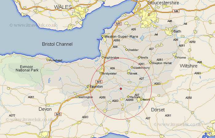
Somerset Map Showing Location of Muchelney
Population: 191
District: South Somerset
Easting: 342721 Northing: 124524
Latitude: 51.02 Longitude: -2.82
 = Muchelney
District: South Somerset
Easting: 342721 Northing: 124524
Latitude: 51.02 Longitude: -2.82
= Muchelney
This Muchelney map below is supplied by Google. Use the tools in the top left corner to zoom into street level or zoom out for a road map, you may also need to zoom in to see Muchelney on the map. Click and drag the map to move around. If the map fails to load try and refresh your browser or zoom in or out (+ or -).
Update - it seems Google no longer allow people to use their maps for free! This Muchelney map sometimes loads and sometimes gives a error. I am working on a solution.
Closest 30 Towns or Cities to Muchelney (Population over 500)
Langport 2.18km Long Sutton 3.5km Kingsbury 3.89km Kingsbury Episcopi 3.89km Curry Rivel 4.66km High Ham 5.56km Somerton 5.95km Fivehead 7.24km Martock 7.26km South Petherton 7.51km Stoke St. Gregory 8.37km Stoke St Gregory 8.37km Stoke Saint Gregory 8.37km Othery 8.75km Tintinhull 8.94km Ilchester 9.51km Montacute 10.2km Ilton 10.2km North Curry 10.49km Yeovilton 10.66km Middlezoy 10.94km Compton 11.6km Ilminster 11.62km Walton 11.65km Charlton Mackrell 11.87km Street 12.06km West Chinnock 12.06km Ashcott 13.02km Shapwick 13.02km Butleigh 13.14km