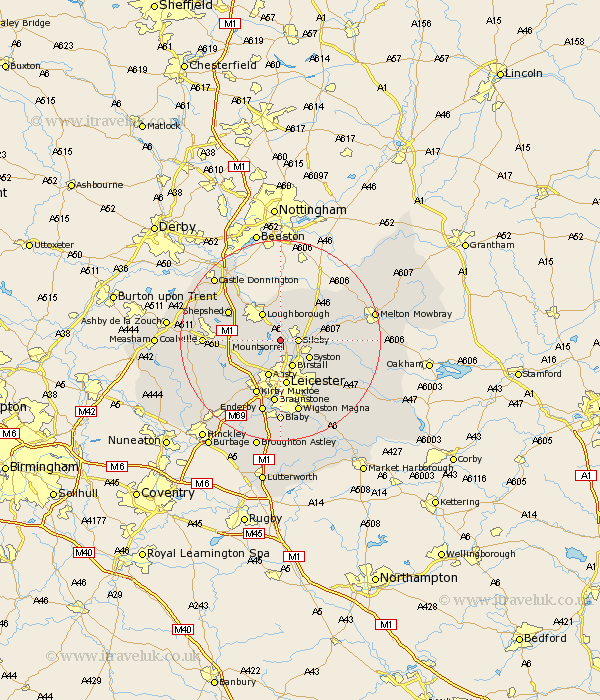
Leicestershire Map Showing Location of Mountsorrel
Population: 8430
Area Size (ha): 196
District: Charnwood
Easting: 457410 Northing: 313603
Latitude: 52.72 Longitude: -1.15
 = Mountsorrel
Area Size (ha): 196
District: Charnwood
Easting: 457410 Northing: 313603
Latitude: 52.72 Longitude: -1.15
= Mountsorrel
This Mountsorrel map below is supplied by Google. Use the tools in the top left corner to zoom into street level or zoom out for a road map, you may also need to zoom in to see Mountsorrel on the map. Click and drag the map to move around. If the map fails to load try and refresh your browser or zoom in or out (+ or -).
Update - it seems Google no longer allow people to use their maps for free! This Mountsorrel map sometimes loads and sometimes gives a error. I am working on a solution.
Closest 30 Towns or Cities to Mountsorrel (Population over 500)
Mountsorrel 0km Barrow 1.85km Barrow upon Soar 1.85km Quorndon 2.16km Rothley 2.17km Sileby 3.37km Woodhouse 3.37km Burton on the Wolds 6km Burton 6km Burton-on-the-Wolds 6km Birstall 6km Loughborough 6.5km Syston 6.73km Ansty 7.75km Anstey 7.75km Rearsby 7.86km Wimeswould 8.13km Wymeswold 8.13km Queniboro 8.69km Queniborough 8.69km Leiscester 9.34km Leicester 9.34km Hathern 10.01km Hoby 10.27km Markfield 10.57km Sheepshed 11.32km Shepshed 11.32km Kirby Muxloe 11.99km Frisby 12.48km Frisby-on-the-Wreak 12.48km