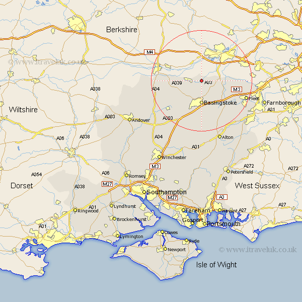
Hampshire Map Showing Location of Mortimer West End
District: Basingstoke and Deane
Easting: 463830 Northing: 161667
Latitude: 51.35 Longitude: -1.08
 = Mortimer West End
Easting: 463830 Northing: 161667
Latitude: 51.35 Longitude: -1.08
= Mortimer West End
This Mortimer West End map below is supplied by Google. Use the tools in the top left corner to zoom into street level or zoom out for a road map, you may also need to zoom in to see Mortimer West End on the map. Click and drag the map to move around. If the map fails to load try and refresh your browser or zoom in or out (+ or -).
Update - it seems Google no longer allow people to use their maps for free! This Mortimer West End map sometimes loads and sometimes gives a error. I am working on a solution.
Closest 30 Towns or Cities to Mortimer West End (Population over 500)
Silchester 1.16km Tadley 3.47km Bramley 3.88km Baughurst 6.08km Sherfield 7.24km Sherfield upon Loddon 7.24km Basingstoke 9.26km Basing 9.89km Rotherwick 10.99km Kingsclere 12.16km Ecchinswell 12.87km Hook 13.1km Oakley 13.11km Hartley Wintney 14.97km Odiham 15.24km Upton Grey 15.91km Burghclere 16.63km Winchfield 16.7km Dummer 17.31km Overton 17.4km Highclere 17.46km North Waltham 18.07km Long Sutton 18.13km Fleet 18.89km Blackwater 21.17km Crondall 21.98km Whitchurch 22.85km East Woodhay 23.15km Froyle 23.45km Bentley 23.89km