Derbyshire Map Showing Location of Allestree
Easting: 434723 Northing: 337482
Latitude: 52.93 Longitude: -1.48
 = Allestree
Latitude: 52.93 Longitude: -1.48
= Allestree
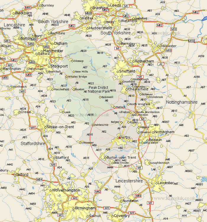
This Allestree map below is supplied by Google. Use the tools in the top left corner to zoom into street level or zoom out for a road map, you may also need to zoom in to see Allestree on the map. Click and drag the map to move around. If the map fails to load try and refresh your browser or zoom in or out (+ or -).
Update - it seems Google no longer allow people to use their maps for free! This Allestree map sometimes loads and sometimes gives a error. I am working on a solution.
Closest 30 Towns or Cities to Allestree (Population over 500)
Derby 1.12km Quarndon 2.17km Breadsall 2.23km Little Eaton 2.9km Duffield 3.71km Kirk Langley 5.59km Holbrook 7.5km Borrowash 7.66km Burnaston 7.88km Kilbourne 8.14km Kilbourn 8.14km Kilburn 8.14km Smalley 8.7km Dale Abbey 8.94km West Hallam 9.13km Brailsford 9.13km Findern 9.85km Etwall 10.77km Denby 10.82km Belper 11.18km Risley 11.32km Heage 11.34km Willington 11.99km Repton 11.99km Ripley 12.44km Weston-on-Trent 12.45km Weston upon Trent 12.45km Weston on Trent 12.45km Ilkeston 12.83km Shardlow 12.88km