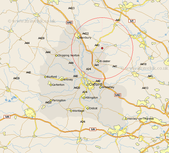
Oxfordshire Map Showing Location of Mixbury
Population: 255
District: Cherwell
Easting: 460657 Northing: 232064
Latitude: 51.98 Longitude: -1.12
 = Mixbury
District: Cherwell
Easting: 460657 Northing: 232064
Latitude: 51.98 Longitude: -1.12
= Mixbury
This Mixbury map below is supplied by Google. Use the tools in the top left corner to zoom into street level or zoom out for a road map, you may also need to zoom in to see Mixbury on the map. Click and drag the map to move around. If the map fails to load try and refresh your browser or zoom in or out (+ or -).
Update - it seems Google no longer allow people to use their maps for free! This Mixbury map sometimes loads and sometimes gives a error. I am working on a solution.
Closest 30 Towns or Cities to Mixbury (Population over 500)
Fringford 3.7km Caversfield 6.53km Fritwell 8.81km Ardley 8.82km Bicester 9.54km Launton 11.12km Upper Heyford 11.68km Chesterton 12.02km Deddington 13.7km Adderbury 13.82km Steeple Aston 14.58km Ambrosden 14.82km Duns Tew 15.85km Kirtlington 16.55km Banbury 16.58km Barford Saint John 17.12km Barford St. John 17.12km Barford 17.12km Barford St John 17.12km Bloxham 17.22km Wardington 17.27km Bletchingdon 18.04km Cropredy 18.86km Tackley 18.87km Islip 20.18km Woodstock 20.2km Wroxton 21.49km Kidlington 21.77km Beckley 22.7km Yarnton 23.95km