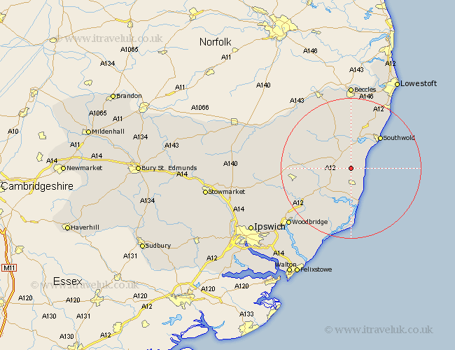
Suffolk Map Showing Location of Middleton
Population: 359
District: Suffolk Coastal
Easting: 643424 Northing: 267351
Latitude: 52.25 Longitude: 1.57
 = Middleton
District: Suffolk Coastal
Easting: 643424 Northing: 267351
Latitude: 52.25 Longitude: 1.57
= Middleton
This Middleton map below is supplied by Google. Use the tools in the top left corner to zoom into street level or zoom out for a road map, you may also need to zoom in to see Middleton on the map. Click and drag the map to move around. If the map fails to load try and refresh your browser or zoom in or out (+ or -).
Update - it seems Google no longer allow people to use their maps for free! This Middleton map sometimes loads and sometimes gives a error. I am working on a solution.
Closest 30 Towns or Cities to Middleton (Population over 500)
Yoxford 3.88km Leiston 5.56km Saxmundham 5.86km Wenhaston 7.5km Snape 8.7km Thorpeness 9.87km Thorpe 9.87km Holton 9.87km Cookley 10.86km Aldeburgh 11.35km Wangford 11.63km Halesworth 12.01km Southwold 12.2km Reydon 13.03km Laxfield 14.7km Tunstall 15.22km Framlingham 16.32km Wrentham 16.81km Wickham Market 17.59km Rendlesham 18.01km Dennington 18.24km Orford 18.67km Ufford 20.93km Kessingland 21.15km Fressingfield 21.27km Worlingworth 21.63km Stradbroke 21.71km Worlingham 22.27km Gisleham 22.79km Bungay 23.61km