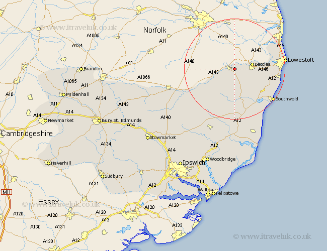
Suffolk Map Showing Location of Mettingham
Population: 202
District: Waveney
Easting: 635535 Northing: 289253
Latitude: 52.45 Longitude: 1.47
 = Mettingham
District: Waveney
Easting: 635535 Northing: 289253
Latitude: 52.45 Longitude: 1.47
= Mettingham
This Mettingham map below is supplied by Google. Use the tools in the top left corner to zoom into street level or zoom out for a road map, you may also need to zoom in to see Mettingham on the map. Click and drag the map to move around. If the map fails to load try and refresh your browser or zoom in or out (+ or -).
Update - it seems Google no longer allow people to use their maps for free! This Mettingham map sometimes loads and sometimes gives a error. I am working on a solution.
Closest 30 Towns or Cities to Mettingham (Population over 500)
Bungay 1.13km Beccles 7.03km Worlingham 7.91km Halesworth 11.35km Holton 13.41km Cookley 14.87km Wangford 15.07km Carlton Colville 15.81km Fressingfield 15.86km Wenhaston 15.86km Wrentham 16.46km Gisleham 17.05km Kessingland 17.35km Reydon 17.54km Laxfield 18.01km Oulton 18.44km Lowestoft 19.55km Southwold 19.61km Stradbroke 20.1km Yoxford 20.66km Hoxne 21.24km Corton 21.63km Dennington 23.31km Worlingworth 25.14km Saxmundham 26.04km Eye 26.11km Framlingham 27.48km Leiston 28.62km Thorndon 29.25km Snape 29.74km