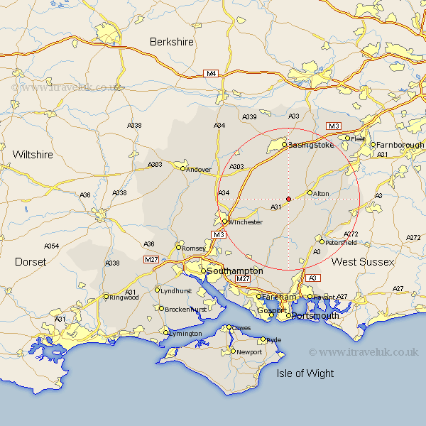
Hampshire Map Showing Location of Medstead
Population: 3771
Area Size (ha): 225
District: East Hampshire
Easting: 465320 Northing: 135740
Latitude: 51.12 Longitude: -1.07
 = Medstead
Area Size (ha): 225
District: East Hampshire
Easting: 465320 Northing: 135740
Latitude: 51.12 Longitude: -1.07
= Medstead
This Medstead map below is supplied by Google. Use the tools in the top left corner to zoom into street level or zoom out for a road map, you may also need to zoom in to see Medstead on the map. Click and drag the map to move around. If the map fails to load try and refresh your browser or zoom in or out (+ or -).
Update - it seems Google no longer allow people to use their maps for free! This Medstead map sometimes loads and sometimes gives a error. I am working on a solution.
Closest 30 Towns or Cities to Medstead (Population over 500)
Four Marks 1.16km Ropley 5.68km Alton 6.1km Upper Farringdon 6.11km Faringdon 6.11km Farringdon 6.11km New Alresford 7.91km Bramdean 9.91km Selborne 10.02km Cheriton 10.19km Dummer 10.93km West Meon 11.18km Froyle 11.85km Upton Grey 12.05km Froxfield 12.06km North Waltham 12.33km Binsted 13.32km Greatham 13.8km Kingsley 13.96km Micheldever 14.08km Long Sutton 14.49km Steep 14.51km Liss 14.89km East Meon 15.02km Bordon 15.12km Bordon Camp 15.12km Bentley 15.79km Petersfield 15.98km Kings Worthy 16.71km Basingstoke 16.72km