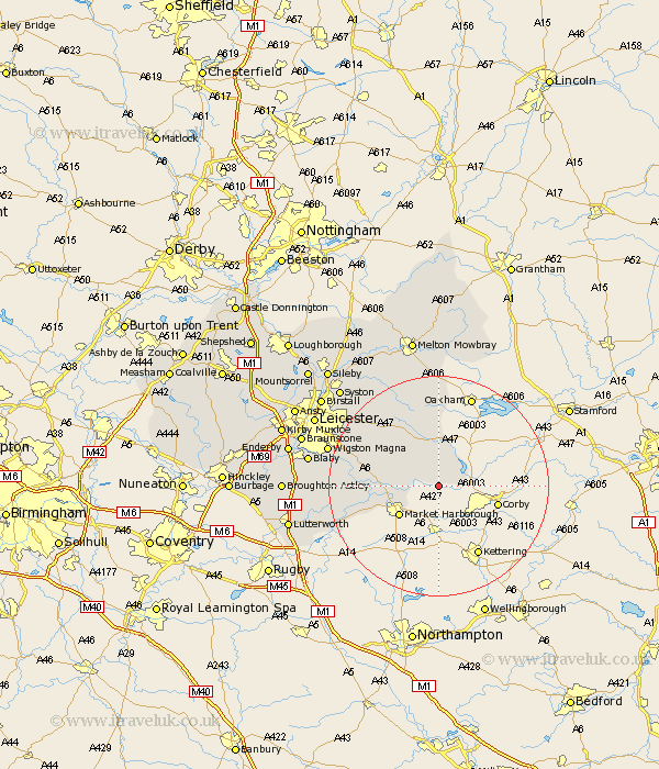
Leicestershire Map Showing Location of Medbourne
Population: 444
District: Harborough
Easting: 480288 Northing: 291678
Latitude: 52.52 Longitude: -0.82
 = Medbourne
District: Harborough
Easting: 480288 Northing: 291678
Latitude: 52.52 Longitude: -0.82
= Medbourne
This Medbourne map below is supplied by Google. Use the tools in the top left corner to zoom into street level or zoom out for a road map, you may also need to zoom in to see Medbourne on the map. Click and drag the map to move around. If the map fails to load try and refresh your browser or zoom in or out (+ or -).
Update - it seems Google no longer allow people to use their maps for free! This Medbourne map sometimes loads and sometimes gives a error. I am working on a solution.
Closest 30 Towns or Cities to Medbourne (Population over 500)
Hallaton 3.87km Great Easton 4.51km Great Bowden 6.75km Bowden 6.75km Market Harborough 8.76km Lubenham 10.6km Kibworth Harcourt 11.43km Kibworth 11.43km Billesdon 12.16km Great Glen 15.67km Houghton-on-the-Hill 15.83km Houghton 15.83km Houghton on the Hill 15.83km Somerby 16.72km Husbands Bosworth 17.45km Twyford 17.99km Oadby 19.49km Wigston 20.54km Wigston Magna 20.54km Glen Parva 21.04km Glen Parka 21.04km Walton 21.06km Walton-in-Knaptoft 21.06km Countesthorpe 21.74km Gaddesby 22.76km Blaby 23.22km Gilmarton 23.24km Gilmorton 23.24km Queniborough 23.61km Queniboro 23.61km