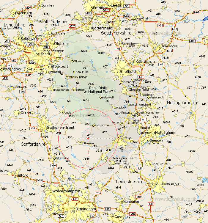
Derbyshire Map Showing Location of Marston Montgomery
Population: 360
District: Derbyshire Dales
Easting: 414561 Northing: 337379
Latitude: 52.93 Longitude: -1.78
 = Marston Montgomery
District: Derbyshire Dales
Easting: 414561 Northing: 337379
Latitude: 52.93 Longitude: -1.78
= Marston Montgomery
This Marston Montgomery map below is supplied by Google. Use the tools in the top left corner to zoom into street level or zoom out for a road map, you may also need to zoom in to see Marston Montgomery on the map. Click and drag the map to move around. If the map fails to load try and refresh your browser or zoom in or out (+ or -).
Update - it seems Google no longer allow people to use their maps for free! This Marston Montgomery map sometimes loads and sometimes gives a error. I am working on a solution.
Closest 30 Towns or Cities to Marston Montgomery (Population over 500)
Doveridge 4.33km Sudbury 7.74km Clifton 7.74km Church Broughton 7.88km Ashbourne 9.86km Scropton 10.29km Brailsford 11.32km Etwall 14.36km Kirk Langley 14.52km Burnaston 15.56km Egginton 16.58km Burton-on-Trent 18.57km Burton on Trent 18.57km Burton upon Trent 18.57km Newton Solney 18.66km Brassington 18.92km Derby 18.99km Quarndon 19.08km Findern 19.16km Repton 19.2km Willington 19.2km Duffield 20.44km Barton 20.87km Barton-under-Needwood 20.87km Barton under Needwood 20.87km Bretby 21.41km Walton 21.46km Walton-on-Trent 21.46km Walton upon Trent 21.46km Walton on Trent 21.46km