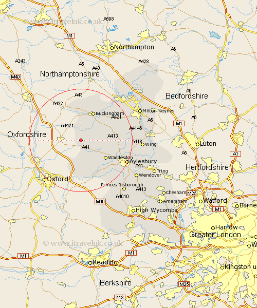
Buckinghamshire Map Showing Location of Marsh Gibbon
Population: 991
District: Aylesbury Vale
Easting: 465356 Northing: 222858
Latitude: 51.9 Longitude: -1.05
 = Marsh Gibbon
District: Aylesbury Vale
Easting: 465356 Northing: 222858
Latitude: 51.9 Longitude: -1.05
= Marsh Gibbon
This Marsh Gibbon map below is supplied by Google. Use the tools in the top left corner to zoom into street level or zoom out for a road map, you may also need to zoom in to see Marsh Gibbon on the map. Click and drag the map to move around. If the map fails to load try and refresh your browser or zoom in or out (+ or -).
Update - it seems Google no longer allow people to use their maps for free! This Marsh Gibbon map sometimes loads and sometimes gives a error. I am working on a solution.
Closest 30 Towns or Cities to Marsh Gibbon (Population over 500)
Twyford 3.88km Grendon Underwood 5.05km Claydon 5.88km Steeple Claydon 5.88km Gawcott 8.17km Tingewick 9.26km Brill 9.27km Quainton 9.87km Padbury 10.1km Oakley 11.18km Waddesdon 11.78km Buckingham 12.02km Maids Moreton 12.5km North Marston 12.72km Thornborough 13.01km Stowe 13.18km Winslow 13.75km Great Horwood 14.59km Warminghall 14.87km Worminghall 14.87km Whitechurch 14.98km Whitchurch 14.98km Long Crendon 15.51km Cuddington 15.88km Akeley 15.88km Chearsley 16.34km Mursley 16.43km Haddenham 17.42km Stone 17.67km Aylesbury 19.51km