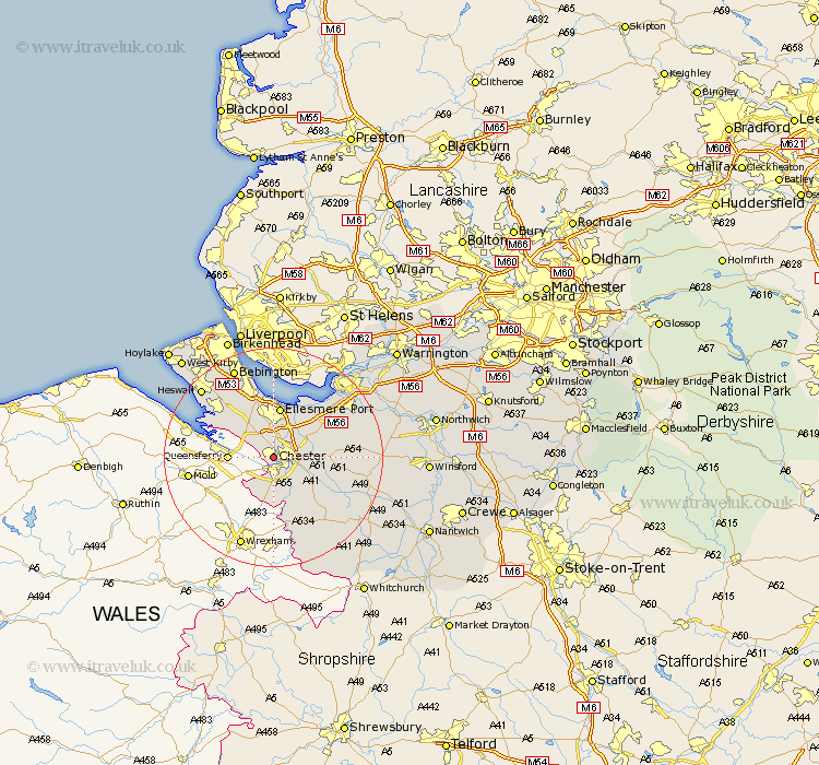
Cheshire Map Showing Location of Chester
Population: 80616
Area Size (ha): 2093
District: Chester
Easting: 338773 Northing: 367415
Latitude: 53.2 Longitude: -2.92
 = Chester
Area Size (ha): 2093
District: Chester
Easting: 338773 Northing: 367415
Latitude: 53.2 Longitude: -2.92
= Chester
This Chester map below is supplied by Google. Use the tools in the top left corner to zoom into street level or zoom out for a road map, you may also need to zoom in to see Chester on the map. Click and drag the map to move around. If the map fails to load try and refresh your browser or zoom in or out (+ or -).
Update - it seems Google no longer allow people to use their maps for free! This Chester map sometimes loads and sometimes gives a error. I am working on a solution.
Closest 30 Towns or Cities to Chester (Population over 500)
Saughall 2.89km Great Saughall 2.89km Mollington 3.7km Christleton 5.85km Mickle Trafford 6.91km Dodleston 7.74km Barrow 7.77km Great Barrow 7.77km Waverton 8.61km Elton 8.67km Ellesmere Port 9.33km Dunham 9.55km Dunham-on-the-Hill 9.55km Dunham on the Hill 9.55km Tarvin 9.99km Willaston 10.8km Ashton 12.35km Helsby 12.44km Neston 12.83km Farndon 13.17km Tattenhall 13.63km Kelsall Hill 15.65km Kelsall 15.65km Kelshall Hill 15.65km Frodsham 16.5km Hale 16.73km Delamere 16.75km Harthill 17.09km Tarporley 17.57km Heswall 17.81km