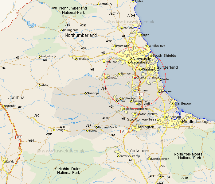
Durham Map Showing Location of Chester Le Street
Population: 34543
Area Size (ha): 989
District: Chester-le-Street
Easting: 427820 Northing: 550673
Latitude: 54.85 Longitude: -1.57
 = Chester Le Street
Area Size (ha): 989
District: Chester-le-Street
Easting: 427820 Northing: 550673
Latitude: 54.85 Longitude: -1.57
= Chester Le Street
This Chester Le Street map below is supplied by Google. Use the tools in the top left corner to zoom into street level or zoom out for a road map, you may also need to zoom in to see Chester Le Street on the map. Click and drag the map to move around. If the map fails to load try and refresh your browser or zoom in or out (+ or -).
Update - it seems Google no longer allow people to use their maps for free! This Chester Le Street map sometimes loads and sometimes gives a error. I am working on a solution.
Closest 30 Towns or Cities to Chester Le Street (Population over 500)
Pelton 2.83km Birtley 3.7km Edmondsley 4.27km Sacriston 4.9km Ouston Moor 5.16km Ouston 5.16km West Rainton 5.65km Houghton le Spring 6.4km Washington 6.41km Washington New Town 6.41km Witton Gilbert 7.01km Pittington 7.71km Lamesley 7.72km Hetton le Hole 8.34km Langley Park 8.48km Ushaw Moor 9.14km Durham 9.26km Stanley 9.49km Shincliffe 9.51km Murton 10.29km Annfield Plain 10.67km Sherburn 10.69km Gateshead 11.05km Gateshead on Tyne 11.05km Gateshead-on-Tyne 11.05km Burnopfield 11.09km Lanchester 11.3km Esh 11.31km Brandon 11.57km Felling 11.68km