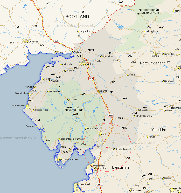
Cumbria Map Showing Location of Lupton
Population: 165
District: South Lakeland
Easting: 356531 Northing: 480331
Latitude: 54.22 Longitude: -2.67
 = Lupton
District: South Lakeland
Easting: 356531 Northing: 480331
Latitude: 54.22 Longitude: -2.67
= Lupton
This Lupton map below is supplied by Google. Use the tools in the top left corner to zoom into street level or zoom out for a road map, you may also need to zoom in to see Lupton on the map. Click and drag the map to move around. If the map fails to load try and refresh your browser or zoom in or out (+ or -).
Update - it seems Google no longer allow people to use their maps for free! This Lupton map sometimes loads and sometimes gives a error. I am working on a solution.
Closest 30 Towns or Cities to Lupton (Population over 500)
Holme 4.94km Kirkby Londsdale 5.73km Kirkby Lonsdale 5.73km Milnthorpe 6.5km Heversham 6.76km Beetham 6.76km Levens 8.44km Natland 8.58km Arnside 11.46km Kendal 12.37km Kendall 12.37km Sedbergh 14.78km Millthrop 14.78km Milnthorpe 14.78km Dent 15.14km Staveley 19.31km Lower Holker 19.86km Holker 19.86km Haverthwaite 22.83km Tebay 22.89km Windermere 23.27km Colton 25.52km Hawkshead 27.32km Ravenstonedale 27.52km Ulverston 28.24km Ulverstone 28.24km Orton 28.54km Ambleside 29.55km Great Urswick 30.21km Aldingham 30.32km