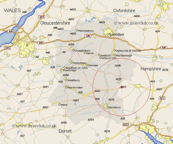
Wiltshire Map Showing Location of Ludgershall
Population: 3558
Area Size (ha): 116
District: Kennet
Easting: 424451 Northing: 144647
Latitude: 51.2 Longitude: -1.65
 = Ludgershall
Area Size (ha): 116
District: Kennet
Easting: 424451 Northing: 144647
Latitude: 51.2 Longitude: -1.65
= Ludgershall
This Ludgershall map below is supplied by Google. Use the tools in the top left corner to zoom into street level or zoom out for a road map, you may also need to zoom in to see Ludgershall on the map. Click and drag the map to move around. If the map fails to load try and refresh your browser or zoom in or out (+ or -).
Update - it seems Google no longer allow people to use their maps for free! This Ludgershall map sometimes loads and sometimes gives a error. I am working on a solution.
Closest 30 Towns or Cities to Ludgershall (Population over 500)
Tidworth 3.88km North Tidworth 3.88km Bulford 8.13km Durrington 8.34km Idmiston 8.75km Collingbourne Ducis 9.26km Figheldean 9.47km Netheravon 10km Amesbury 10km Lark Hill 11.76km Enford 11.83km Winterslow 13.03km Winterbourne 13.13km Winterbourne Dauntsey 13.13km Upavon 14.85km Grafton 14.87km Burbage 14.87km Pewsey 16.37km Farley 16.84km Salisbury 17.5km New Sarum 17.5km Shrewton 17.52km Shalbourn 18.07km Shalbourne 18.07km South Newton 18.76km Great Bedwyn 18.86km Bedwyn 18.86km Alderbury 19.43km Wilton 19.92km Britford 20.25km