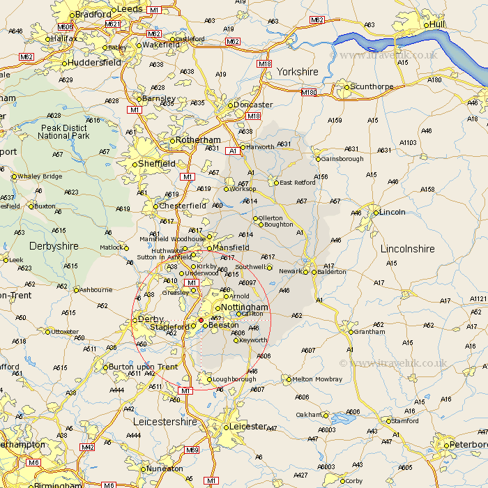
Nottinghamshire Map Showing Location of Chilwell
District: Broxtowe
Easting: 451525 Northing: 337632
Latitude: 52.93 Longitude: -1.23
 = Chilwell
Easting: 451525 Northing: 337632
Latitude: 52.93 Longitude: -1.23
= Chilwell
This Chilwell map below is supplied by Google. Use the tools in the top left corner to zoom into street level or zoom out for a road map, you may also need to zoom in to see Chilwell on the map. Click and drag the map to move around. If the map fails to load try and refresh your browser or zoom in or out (+ or -).
Update - it seems Google no longer allow people to use their maps for free! This Chilwell map sometimes loads and sometimes gives a error. I am working on a solution.
Closest 30 Towns or Cities to Chilwell (Population over 500)
Beeston 2.16km Stapleford 2.9km Trowell 3.35km Cossall 5km Nottigham 5.81km Nottingham 5.81km Kimberley 5.99km Awsworth 6.49km Ruddington 7.88km West Bridgford 8.04km West Bridgeford 8.04km Eastwood 8.66km Gotham 9.53km Greasley 9.54km Arnold 9.99km Colwick 10.22km Carlton 10.22km Tollerton 10.22km Brinsley 10.82km Sutton Bonington 11.18km Bunny 11.44km Lambley 12.47km Annesley 13.02km Papplewick 13.4km Radcliffe on Trent 13.4km Radcliffe 13.4km Radcliffe-on-Trent 13.4km East Leake 13.71km Cotgrave 13.91km Burton Joyce 14.51km