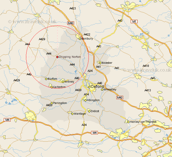
Oxfordshire Map Showing Location of Chipping Norton
Population: 5311
Area Size (ha): 129
District: West Oxfordshire
Easting: 432129 Northing: 218832
Latitude: 51.94 Longitude: -1.53
 = Chipping Norton
Area Size (ha): 129
District: West Oxfordshire
Easting: 432129 Northing: 218832
Latitude: 51.94 Longitude: -1.53
= Chipping Norton
This Chipping Norton map below is supplied by Google. Use the tools in the top left corner to zoom into street level or zoom out for a road map, you may also need to zoom in to see Chipping Norton on the map. Click and drag the map to move around. If the map fails to load try and refresh your browser or zoom in or out (+ or -).
Update - it seems Google no longer allow people to use their maps for free! This Chipping Norton map sometimes loads and sometimes gives a error. I am working on a solution.
Closest 30 Towns or Cities to Chipping Norton (Population over 500)
Churchill 5.33km Chadlington 6.05km Enstone 6.13km Hook Norton 6.21km Kingham 7.02km Barton 7.71km Charlbury 9.03km Shipton under Wychwood 10.23km Shipton-under-Wychwood 10.23km Shipton 10.23km Barford Saint John 12.54km Barford St. John 12.54km Barford 12.54km Barford St John 12.54km Leafield 13.34km Stonesfield 13.39km Bloxham 13.41km Duns Tew 13.72km Minster Lovell 15.2km Hailey 15.58km Deddington 15.72km Steeple Aston 16.15km Adderbury 16.43km Burford 16.68km North Leigh 16.68km Tackley 16.78km Wroxton 17.1km Witney 17.4km Woodstock 17.72km Upper Heyford 18.29km