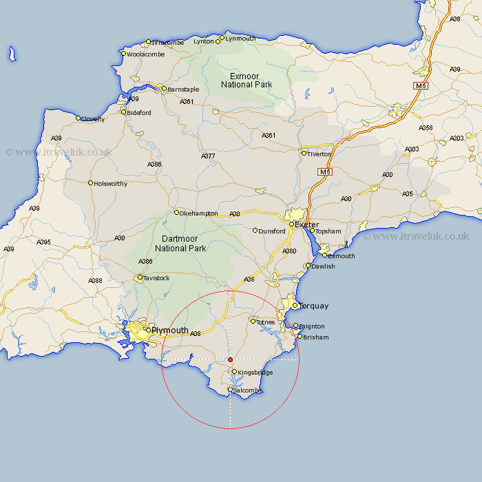
Devon Map Showing Location of Loddiswell
Population: 891
District: South Hams
Easting: 273051 Northing: 47896
Latitude: 50.32 Longitude: -3.78
 = Loddiswell
District: South Hams
Easting: 273051 Northing: 47896
Latitude: 50.32 Longitude: -3.78
= Loddiswell
This Loddiswell map below is supplied by Google. Use the tools in the top left corner to zoom into street level or zoom out for a road map, you may also need to zoom in to see Loddiswell on the map. Click and drag the map to move around. If the map fails to load try and refresh your browser or zoom in or out (+ or -).
Update - it seems Google no longer allow people to use their maps for free! This Loddiswell map sometimes loads and sometimes gives a error. I am working on a solution.
Closest 30 Towns or Cities to Loddiswell (Population over 500)
East Allington 3.55km Kingsbridge 3.9km Aveton Gifford 4.01km West Alvington 6.04km Modbury 8.01km Thurlestone 8.12km Thurleston 8.12km Ugborough 8.79km Blackawton 9.07km Diptford 9.26km Salcombe 9.27km Malborough 9.35km Stokenham 9.98km Street 10.65km Strete 10.65km Ermington 10.97km Holbeton 11.98km Ivybridge 12.02km Harberton 12.08km Stoke Fleming 13.02km Brent 13.44km South Brent 13.44km Totnes 13.74km Dartmouth 14.67km Yealmpton 14.67km Stoke Gabriel 15.02km Kingswear 15.82km Berry Pomeroy 16.05km Cornwood 17.11km Staverton 17.69km