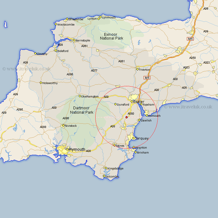
Devon Map Showing Location of Chudleigh
Population: 2967
Area Size (ha): 64
District: Teignbridge
Easting: 287959 Northing: 79070
Latitude: 50.6 Longitude: -3.58
 = Chudleigh
Area Size (ha): 64
District: Teignbridge
Easting: 287959 Northing: 79070
Latitude: 50.6 Longitude: -3.58
= Chudleigh
This Chudleigh map below is supplied by Google. Use the tools in the top left corner to zoom into street level or zoom out for a road map, you may also need to zoom in to see Chudleigh on the map. Click and drag the map to move around. If the map fails to load try and refresh your browser or zoom in or out (+ or -).
Update - it seems Google no longer allow people to use their maps for free! This Chudleigh map sometimes loads and sometimes gives a error. I am working on a solution.
Closest 30 Towns or Cities to Chudleigh (Population over 500)
Kingsteignton 5.56km Hennock 5.88km Bishopsteignton 6.59km Christow 7.28km Bovey Tracey 7.3km Newton Abbot 7.51km Dawlish 8.44km Kenton 9.03km Starcross 9.59km Lustleigh 9.59km Stokeinteignhead 9.91km Teignmouth 9.94km Kingskerswell 11.12km Ide 11.18km Ilsington 11.22km Abbotskerswell 11.37km Exminster 11.64km Dunsford 11.64km Exeter 11.66km Denbury 12.08km Lympstone 13km Moretonhampstead 13.01km Exmouth 13.02km Topsham 13.2km Holcombe Burnell 13.45km Ipplepen 13.45km Broadhempston 14.78km Whitestone 14.87km Marldon 14.87km Ashburton 14.98km