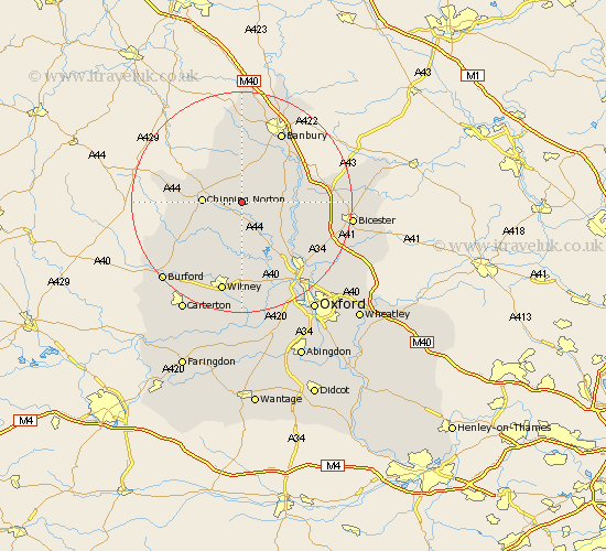
Oxfordshire Map Showing Location of Little Tew
Population: 153
District: West Oxfordshire
Easting: 438956 Northing: 226287
Latitude: 51.93 Longitude: -1.43
 = Little Tew
District: West Oxfordshire
Easting: 438956 Northing: 226287
Latitude: 51.93 Longitude: -1.43
= Little Tew
This Little Tew map below is supplied by Google. Use the tools in the top left corner to zoom into street level or zoom out for a road map, you may also need to zoom in to see Little Tew on the map. Click and drag the map to move around. If the map fails to load try and refresh your browser or zoom in or out (+ or -).
Update - it seems Google no longer allow people to use their maps for free! This Little Tew map sometimes loads and sometimes gives a error. I am working on a solution.
Closest 30 Towns or Cities to Little Tew (Population over 500)
Enstone 2.17km Hook Norton 6.53km Duns Tew 6.86km Chipping Norton 6.87km Barford Saint John 7.2km Barford St. John 7.2km Barford 7.2km Barford St John 7.2km Charlbury 7.75km Chadlington 7.98km Bloxham 8.71km Steeple Aston 9.33km Deddington 9.74km Adderbury 10.9km Tackley 10.9km Churchill 10.93km Stonesfield 11.12km Upper Heyford 11.43km Woodstock 12.24km Kingham 13.11km Kirtlington 13.62km Barton 13.74km Fritwell 13.83km Shipton 13.85km Shipton under Wychwood 13.85km Shipton-under-Wychwood 13.85km Bladon 14.17km Leafield 14.67km Banbury 14.67km Bletchingdon 14.72km