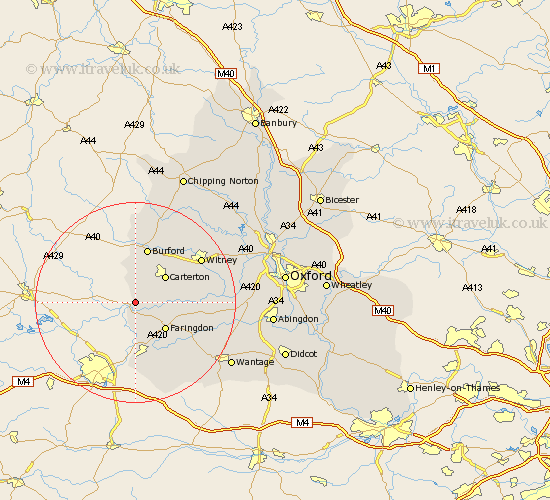
Oxfordshire Map Showing Location of Little Faringdon
Population: 63
District: West Oxfordshire
Easting: 423033 Northing: 200243
Latitude: 51.7 Longitude: -1.67
 = Little Faringdon
District: West Oxfordshire
Easting: 423033 Northing: 200243
Latitude: 51.7 Longitude: -1.67
= Little Faringdon
This Little Faringdon map below is supplied by Google. Use the tools in the top left corner to zoom into street level or zoom out for a road map, you may also need to zoom in to see Little Faringdon on the map. Click and drag the map to move around. If the map fails to load try and refresh your browser or zoom in or out (+ or -).
Update - it seems Google no longer allow people to use their maps for free! This Little Faringdon map sometimes loads and sometimes gives a error. I am working on a solution.
Closest 30 Towns or Cities to Little Faringdon (Population over 500)
Clanfield 5.74km Carterton 7.99km Faringdon 8km Shilton 8.72km Bampton 9.37km Brize Norton 10.12km Shrivenham 11.18km Burford 11.35km Watchfield 11.36km Buckland 12.07km Stanford in the Vale 13.68km Ducklington 13.8km Minster Lovell 14.42km Uffington 15.27km Witney 15.66km Leafield 15.89km Longworth 16.19km Hailey 16.82km Standlake 17.33km Kingston Bagpuize 17.63km Kingston Bagpuze 17.63km Shipton under Wychwood 17.64km Shipton 17.64km Shipton-under-Wychwood 17.64km Childrey 18.12km Stanton Harcourt 18.74km North Leigh 19.54km East Challow 19.8km East Hanney 20.6km Hanney 20.6km