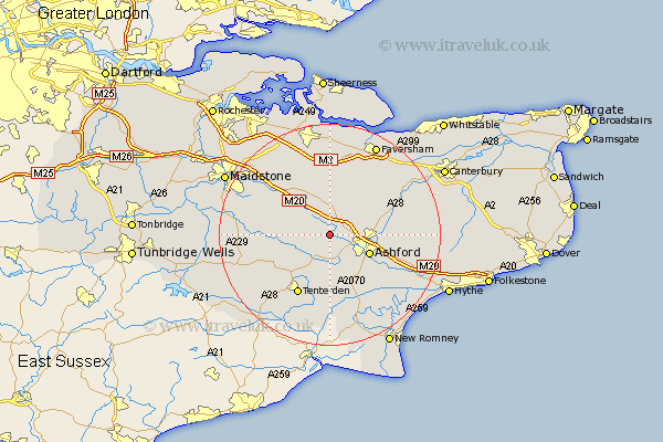
Kent Map Showing Location of Little Chart
Population: 239
District: Ashford
Easting: 594569 Northing: 144569
Latitude: 51.17 Longitude: 0.78
 = Little Chart
District: Ashford
Easting: 594569 Northing: 144569
Latitude: 51.17 Longitude: 0.78
= Little Chart
This Little Chart map below is supplied by Google. Use the tools in the top left corner to zoom into street level or zoom out for a road map, you may also need to zoom in to see Little Chart on the map. Click and drag the map to move around. If the map fails to load try and refresh your browser or zoom in or out (+ or -).
Update - it seems Google no longer allow people to use their maps for free! This Little Chart map sometimes loads and sometimes gives a error. I am working on a solution.
Closest 30 Towns or Cities to Little Chart (Population over 500)
Pluckley 2.97km Hothfield 2.98km Charing 3.88km Egerton 3.94km Bethersden 5.68km Kennington 7.22km Shadoxhurst 7.77km Smarden 7.9km Ashford 7.9km Lenham 8.74km Kingsnorth 8.76km Ulcombe 10km Harrietsham 10.17km High Halden 10.38km Wye 10.62km Hinxhill 11.1km Woodchurch 11.18km Doddington 11.18km Headcorn 11.77km Orlestone 12.05km Tenterden 12.62km Biddenden 12.83km Mersham 12.83km Hollingbourne 13.12km Leeds 13.77km Ham Street 13.79km Smeeth 13.95km Sutton Valence 14.42km Frittenden 14.44km Selling 14.49km