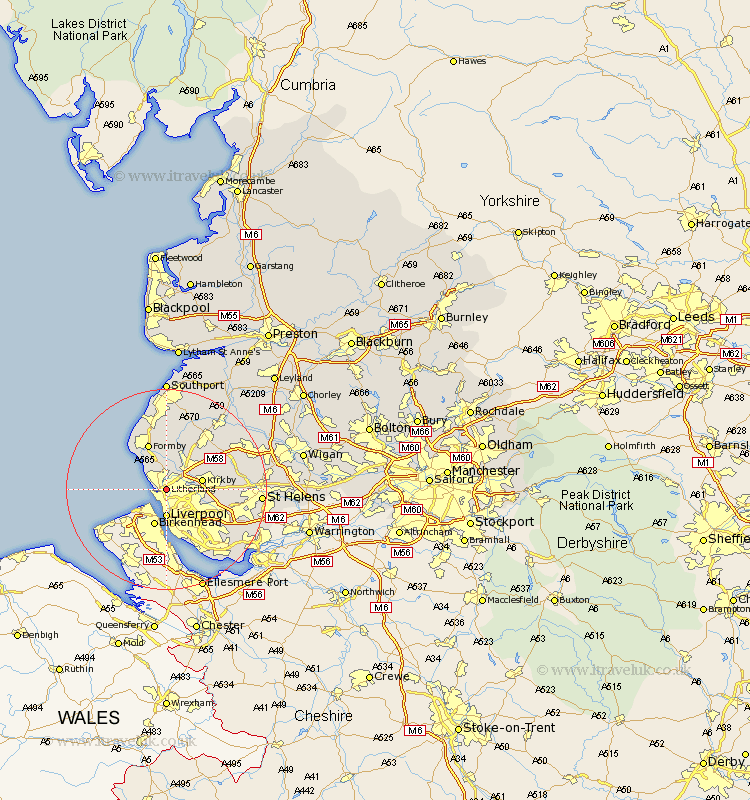
Lancashire Map Showing Location of Litherland
Population: 20473
Area Size (ha): 369
District: Sefton
Easting: 333622 Northing: 397155
Latitude: 53.47 Longitude: -3
 = Litherland
Area Size (ha): 369
District: Sefton
Easting: 333622 Northing: 397155
Latitude: 53.47 Longitude: -3
= Litherland
This Litherland map below is supplied by Google. Use the tools in the top left corner to zoom into street level or zoom out for a road map, you may also need to zoom in to see Litherland on the map. Click and drag the map to move around. If the map fails to load try and refresh your browser or zoom in or out (+ or -).
Update - it seems Google no longer allow people to use their maps for free! This Litherland map sometimes loads and sometimes gives a error. I am working on a solution.
Closest 30 Towns or Cities to Litherland (Population over 500)
Bootle 1.1km Crosby 2.53km Thornton 3.7km Sefton 4.31km Aintree 4.41km Liverpool 5.56km Ince Blundell 5.67km Melling 5.82km Lydiate 5.98km Hightown 6.47km Maghull 6.47km Kirkby 6.87km Aughton 9.23km Formby 9.84km Knowsley 10.1km Bickerstaffe 12.35km Huyton 12.4km Huyton with Roby 12.4km Ormskirk 12.94km Halsall 13.38km Rainford 14.35km Prescot 14.37km Prescott 14.37km Eccleston 14.47km Skelmersdale 15.16km Scarisbrick 15.46km Lathom 16.45km Halewood 16.47km Burscough 17.02km Rainhill 17.14km